Search All Items
- Filters:
- Type
- Image 3891
- Still Image 286
- Text 228
- Text 16
- Language
- English 4317
- Spanish 107
- ENGLISH 1
- census_013 1
Search Results 1191 to 1200 of 4439
-
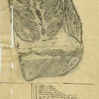
Hand-drawn sketch map of Punta del Monte, or Rincon de la Monte, or Rincon del la Punta de Monte de la Soledad boundaries. Volume 1, page 140.
Date: 1836
-
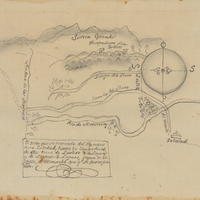
Hand-drawn sketch map of Cañada Larga o Verde boundaries. Volume 2, page 5.
Date: 1840
-
Hand-drawn sketch map of Sayent or Zaygente or Zayanta boundaries. Volume 1, page 196.
Date: 1833
-
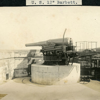
Caption: "U.S. 12" Barbett [sic]." A view of a barbette (gun emplacement) with a 12" gun, at what appears to be a coastal defense battery.
Date: Undated
-
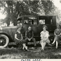
Caption: "Clear Lake.," c. 1920. William (second from left) and Grace (far right) McCarthy seated around an automobile in a picnic area or campground, with two unidentified women.
Date: 1920
-
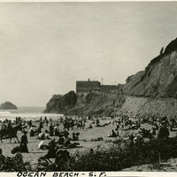
Caption: "Ocean Beach - S.F," c. 1910, shows a large group of sunbathers on San Francisco's Ocean Beach.
Date: 1910