Search All Items
- Filters:
- Type
- Image 3891
- Still Image 286
- Text 228
- Text 16
- Language
- English 4317
- Spanish 107
- ENGLISH 1
- census_013 1
Search Results 1201 to 1210 of 4439
-
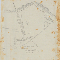
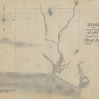
Hand-drawn sketch map of Rincon de San Pascual boundaries. Volume 1, page 386.
Date: 1843
-
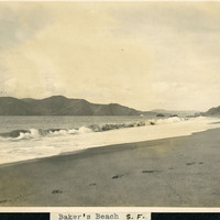
Caption: "Baker's [sic] Beach S.F.," c. 1906. Baker Beach begins just south of Golden Gate Point and extends approximately one half-mile southward to Seacliff Peninsula.
Date: 1906
-
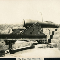
Caption: "U.S., Old Timers." A view of two large guns in carriages, at an unidentified location.
Date: Undated
-
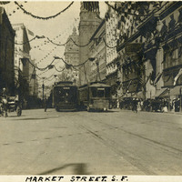
Caption: "Market Street, S.F," 1910. Market Street scene with trolleys, horse-drawn buggies, and people walking about.
Date: 1910