Search All Items
- Filters:
- Type
- Image 3888
- Still Image 2857
- Text 431
- Text 50
- Image of the California Census from the records of the office of the California Secretary of State 1
- Language
- English 7190
- Spanish 43
- ENGLISH 3
- English 2
- census_013 1
- contra_costa_schedule_1_volume_1 1
Search Results 1301 to 1310 of 7317
-
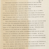
Press release regarding agricultural work program for Japanese-American evacuees
Date: June 11, 1942
-
The Census of 1852 collection includes enumerations of California's 32 counties, arranged into 126 volumes. Schedule I enumerated the county's inhabitants, while schedule II enurmerated economic production. Many pages of this volume are damaged.
Date: 1852
-
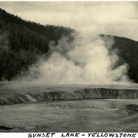
Caption: "Sunset Lake - Yellowstone," c. 1923. Yellowstone National Park's Sunset Lake is a shallow thermal pool in the Black Sand Basin. Its name is derived from the yellow and orange bands of bacteria and algae at its edges.
Date: 1923
-
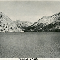
Caption: "Tenaya Lake." Lake with surrounding mountains. Named after Chief Tenaya of Yosemite Valley's Ahwahnechee People, Tenaya Lake is located between Yosemite Valley and Tuolumne Meadows within Yosemite National Park. The surface elevation of the alpine lake is 8,150 feet.
Date: 1927
-
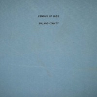
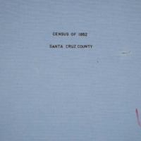
The Census of 1852 collection includes enumerations of California's 32 counties, arranged into 126 volumes. Schedule I enumerated the county's inhabitants, while schedule II enurmerated economic production. Many pages of this volume are damaged.
Date: 1852
-
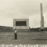
Caption: "Pan-American Highway monument marking the highway completion, July 1, 1936 Altitude 8209 feet. Highest point on route - 15 miles south of Octopan [sic], Mexico." Pictured is William McCarthy standing before the "Monument of Good Friendship (El Monumento de Buena Amistad), near Actopan, Mexico.
Date: 1938