Search All Items
- Filters:
- Type
- Image 1473
- Still Image 304
- Text 72
- Text 19
- Language
- English 1654
- Spanish 215
- ENGLISH 2
- English 1
- census_013 1
Search Results 1341 to 1350 of 1881
-
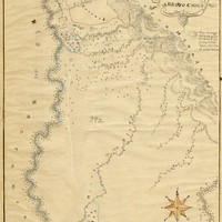
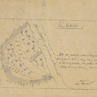
Hand-drawn sketch map of Chupucanes, or Monte del Diablo boundaries. Volume 1, page 140.
Date: 1827
-
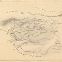
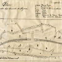
Hand-drawn sketch map of Fort Ross Rancho or Muniz boundaries. Volume 2, page 152.
Date: 1844
-
Hand-drawn sketch map of Land- Mission San Buenaventura boundaries. Volume 2, page 138.
Date: 1845
-
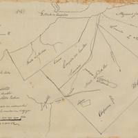
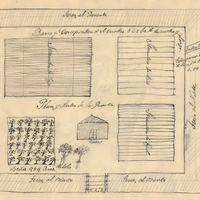
Hand-drawn sketch map of San Juan Bautista boundaries. Volume 2, page 58.
Date: 1843
-
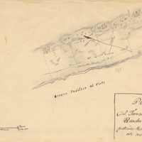
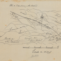
Hand-drawn sketch map of Patrocinio, or Todos Santos y San Antonio boundaries. Volume 1, page 670.
Date: 1840