Search All Items
- Filters:
- Type
- Image 1312
- Still Image 275
- Text 176
- Text 19
- Language
- English 1628
- Spanish 154
- ENGLISH 2
- English 1
- census_013 1
Search Results 1361 to 1370 of 1804
-
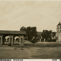
Caption: "Santa Barbara Mission, May 23, 1935," was established in 1786 by Spanish Franciscan monks.
Date: 1935
-
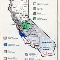
Map indicating the coverage area of the relocation offices and their representatives
Date: August 27, 1945
-
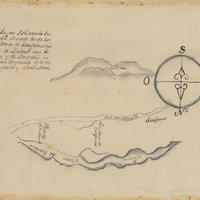
Hand-drawn Sketch map of Punta del Monte boundaries. Volume 1, page 164.
Date: 1834
-
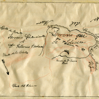
Hand-drawn sketch map of San Clemente or Tamalpais boundaries. Volume 2, page 124.
Date: 1845