Search All Items
- Filters:
- Type
- Image 1473
- Still Image 304
- Text 72
- Text 19
- Language
- English 1654
- Spanish 215
- ENGLISH 2
- English 1
- census_013 1
Search Results 1371 to 1380 of 1881
-
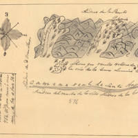
Hand-drawn sketch map of Santa Ana del Chino Sobrante boundaries. Volume 2, page 181.
Date: 1843
-
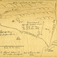
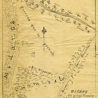
Hand-drawn sketch map of Cuyama or Cuyoma boundaries. Volume 2, page 202.
Date: 1846
-
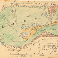
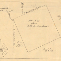
Hand-drawn sketch map of Nietos Addition boundaries. Volume 2, page 205.
Date: 1846
-
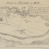
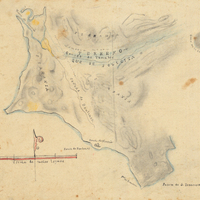
Hand-drawn sketch map of Land- Monterey county, or Lomas del Carmelo or Meadows Tract boundaries. Volume 2, page 29.
Date: 1833
-
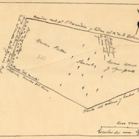
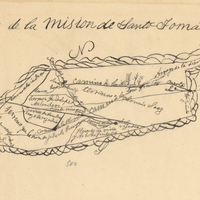
Hand-drawn sketch map of Lot- Mission-San Gabriel boundaries. Volume 2, page 189.
Date: 1843