Search All Items
- Filters:
- Type
- Image 3783
- Still Image 592
- Text 367
- Text 19
- Image of the California Census from the records of the office of the California Secretary of State 1
- Language
- English 4752
- Spanish 11
- ENGLISH 2
- English 1
- census_013 1
- contra_costa_schedule_1_volume_1 1
Search Results 1411 to 1420 of 4815
-
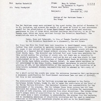
Office Memorandum from Mary M. LeHane to Bertha S. Underhill regarding summary of review in San Diego, CA
Date: November 26, 1945
-
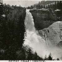
Caption: "Nevada Falls [sic]," c. 1917. Nevada Fall is a 594-foot high waterfall upstream of Vernal Fall on the Merced River, in the Little Yosemite Valley.
Date: 1917
-
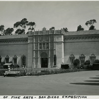
Caption: "Palace of Fine Arts-San Diego Exposition," 1935. Grace is seen here resting before the Palace of Fine Arts at the California-Pacific International Exposition.
Date: 1935
-
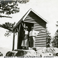
Caption: "Summit -- Tahoe, Placerville Highway." William and Grace McCarthy standing in front of a small wood shed, likely along what is now U.S. Route 50 east of Placerville.
Date: 1927
-
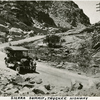
Caption: "Sierra Summit, Truckee Highway." Mountain scene showing car on road with switch-backs, probably along what is now Interstate 80.
Date: 1927
-
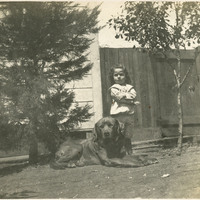
No caption. An unidentified young child is seen standing next to a large dog, in a yard at an unidentified location, c. 1906.
Date: 1906
-
Caption: "Mount Rainier - Rainier National Park," c. 1935, shows glaciers on the 14,410 foot mountain. An iconic landmark on the Washington landscape, Mt. Rainier is an active volcano.
Date: 1935
-
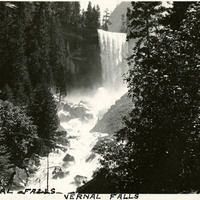
Caption: "Vernal Falls [sic]," c. 1917. Vernal Fall is a 317-foot waterfall on the Merced River, downstream of Nevada Fall.
Date: 1917