Search All Items
- Filters:
- Language
- English 4770
- Spanish 11
- ENGLISH 2
- English 1
- census_013 1
- contra_costa_schedule_1_volume_1 1
- Type
- Image 3784
- Still Image 594
- Text 377
- Text 22
- Textual 2
- Image of the California Census from the records of the office of the California Secretary of State 1
Search Results 1411 to 1420 of 4833
-
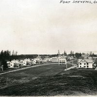
Caption: "Fort Stevens, Oregon," c. 1905. Panorama of Fort Stevens, built in the 1860s as part of the defensive fortifications guarding the mouth of the Columbia River. Located on the Oregon side of the river, the fort was decommissioned after World War II, its armaments and buildings removed and auctioned off. The site now serves as a state park complete with military museum.
Date: 1905
-
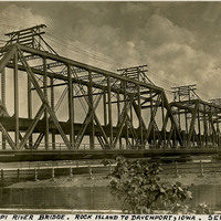
Caption: "Mississippi River Bridge. Rock Island to Davenport, Iowa. Sept. 25, 1934." View of the Government Bridge spanning the Mississippi River between Rock Island and Davenport, Iowa. Built in 1896 and designed by Ralph Modjeski, the bridge in this photograph was the fourth bridge constructed at the site, replacing earlier structures made obsolete by the increasing volume and changing character of traffic. This double-decker bridge connected the U.S. arsenal on Rock Island with Davenport, Iowa, and featured a double rail road track, a separate deck for automobiles, and a swing section. The bridge is still in use today.
Date: 9/25/1934
-
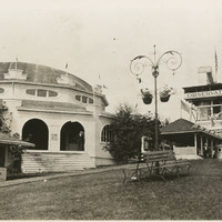
No Caption: See also 96-07-08-alb05-185, with caption: "Council Crest -- Portland," Buildings and benches in a park setting, with a tall observation tower, labeled the "Observatory," at the right side of the photograph. Council Crest Park in Portland, Oregon was the site of an amusement park between 1907 and 1929. The buildings in this photograph were part of that park. The Observatory, built in 1907, was demolished in 1941 to make room for a water tower. The area is still in use as a municipal park.
Date: 1909
-
Caption: "Tamalpais Views," is a label for photographs 179 - 184 in album 6, showing a variety of views of Mount Tamalpais in Marin County.
Date: Undated
-
Caption: "Spanish Type Home -- Key West. July 2, 1934." View of a multi-story residence in Key West. Much of the building is obscured by surrounding vegetation.
Date: 7/2/1934
-
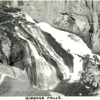
Caption: "Gibbons Falls," c. 1923. Yellowstone National Park's Gibbon Falls is located on the Gibbon River. The falls drop roughly eighty-four feet in a gradual descent.
Date: 1923
-
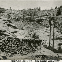
Caption: "Sierra Summit -- Truckee Highway." Mountain scene, showing roadway with car in center of photograph. Likely along what is now Interstate 80.
Date: 1927
-
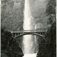
No caption, c. 1920. Waterfall with lush vegetation along the Columbia River in Oregon. The Benson Footbridge, built in 1914, is featured at the center of the photograph.
Date: 1920
-
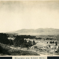
Caption: "Presidio and Golden Gate," c. 1906. A high vantage point view of the Presidio and Golden Gate. Established in 1776 by Spanish explorers, the Presidio is a fortified location overlooking the Golden Gate, the entrance into San Francisco Bay. It was closed as a military structure in 1995, and is now a park within the Golden Gate National Recreation Area.
Date: 1906
-
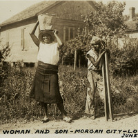
Caption: "Negro Woman and Son -- Morgan City -- Louisiana, June 13, 1934." Unidentified African-American woman and young man along a road in Morgan City. The woman is carrying a pail on her head, while the young man is carrying two wood planks.
Date: 6/13/1934