Search All Items
- Filters:
- Language
- English 4767
- Spanish 11
- ENGLISH 2
- English 1
- census_013 1
- contra_costa_schedule_1_volume_1 1
- Type
- Image 3783
- Still Image 592
- Text 377
- Text 22
- Textual 2
- Image of the California Census from the records of the office of the California Secretary of State 1
Search Results 1431 to 1440 of 4830
-
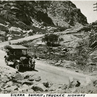
Caption: "Sierra Summit, Truckee Highway." Mountain scene showing car on road with switch-backs, probably along what is now Interstate 80.
Date: 1927
-
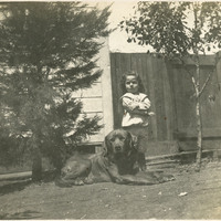
No caption. An unidentified young child is seen standing next to a large dog, in a yard at an unidentified location, c. 1906.
Date: 1906
-
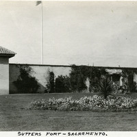
Caption: "Sutters [sic] Fort - Sacramento," c. 1920, shows a gun tower at Sutter's Fort, and a gate bracketed by two cannons. John Sutter established the fort in 1839, calling it New Helvetia. After the discovery of gold at one of Sutter's mills (at Coloma, on the American River), almost all of the fort's inhabitants left for the gold fields in the foothills. The fort deteriorated until being restored from 1891-1893. The Native Sons of the Golden West were influential in the restoration. The fort is now the site of a State Historic Park. See also 96-07-08-alb05-117 and 118.
Date: 1920
-
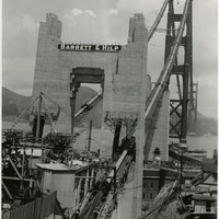
Caption: "Golden Gate Bridge, Construction, July 1, 1936." Image of one terminus of the Golden Gate Bridge, showing the anchoring site of the suspension wires. Completed in 1937, the Golden Gate Bridge spans the mouth of San Francisco Bay (called the Golden Gate), connecting San Francisco with Marin County to the north. It is one of the most recognizable bridges in the world, and was named in 1994 as one of the Modern Wonders of the World by the American Society of Civil Engineers.
Date: 7/1/1936
-
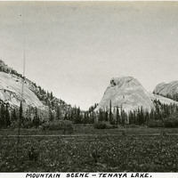
Caption: "Mountain Scene -- Tenaya Lake." Meadow with surrounding rocks and mountains. Named after Chief Tenaya of Yosemite Valley's Ahwahnechee People, Tenaya Lake is located between Yosemite Valley and Tuolumne Meadows within Yosemite National Park. The surface elevation of the alpine lake is 8,150 feet.
Date: 1927
-
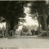
Caption: "The Alameda of Presidio," c. 1910. Established in 1776 by Spanish explorers, the Presidio is a fortified location overlooking the Golden Gate, the entrance into San Francisco Bay. It was closed as a military structure in 1995, and is now a park within the Golden Gate National Recreation Area.
Date: 1910
-
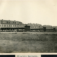
Caption: "Presidio Barracks," c. 1906. Five barrack structures of the Presidio. Established in 1776 by Spanish explorers, the Presidio is a fortified location overlooking the Golden Gate, the entrance into San Francisco Bay. It was closed as a military structure in 1995, and is now a park within the Golden Gate National Recreation Area.
Date: 1906
-
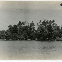
Caption: "Echo Park [sic] Los Angeles," c. 1910. View across Echo Lake at lush vegetation along the far lake edge. Echo Lake Park opened in 1895. The lake was originally created in 1868 to support the operations of a mill. The mill, however, closed seven years later. The site was later selected for conversion to a city park.
Date: 1910
-
Caption: "Old City Hall Tower," San Francisco, c. 1905. A view of the San Francisco City Hall, built in 1870, before it was damaged beyond repair by the 1906 earthquake and fires. A new city hall, near the site of the original, was completed in 1916.
Date: 1905
-
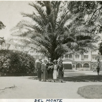
Caption: "Del Monte," c. 1920. Five unidentified women standing in front of a palm tree on the grounds of the Hotel Del Monte. The photograph shows the second of three hotels built on the site, near Monterey, California (this building was destroyed by fire in 1924). The property surrounding the hotel became known as Pebble Beach.
Date: 1920