Search All Items
- Filters:
- Language
- English 4772
- Spanish 11
- ENGLISH 2
- English 1
- census_013 1
- contra_costa_schedule_1_volume_1 1
- Type
- Image 3784
- Still Image 595
- Text 378
- Text 22
- Textual 2
- Image of the California Census from the records of the office of the California Secretary of State 1
Search Results 1511 to 1520 of 4835
-
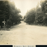
Caption: "Presidio Main Avenue," c. 1906, shows a tree lined dirt road in the Presidio. Established in 1776 by Spanish explorers, the Presidio is a fortified location overlooking the Golden Gate, the entrance into San Francisco Bay. It was closed as a military structure in 1995, and is now a park within the Golden Gate National Recreation Area.
Date: 1906
-
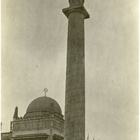
Caption: "Column of Progress," in the Forecourt of Stars. At top of column is The Adventurous Bowman (Hermon A. MacNeil, sculptor), and at the base of the column is a four panel frieze (Isadore Konti, sculptor), at the Panama-Pacific International Exposition.
Date: 1915
-
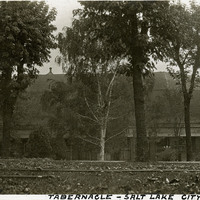
Caption: "Tabernacle -- Salt Lake City," c. 1916. View of the domed Salt Lake Tabernacle, built from 1864-1867. The Tabernacle housed meetings of the Church of Jesus Christ of Latter Day Saints until new facilities were constructed in 2000. The Tabernacle is home to the Mormon Tabernacle Choir, and is considered to be one of the most acoustically perfect buildings in the world due to its unique dome-shaped roof.
Date: 1916
-
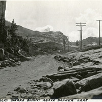
Caption: "The Rocky Sierra Summit Above Donner Lake." Mountain scene with dirt and graveled roadway, likely along what is now Interstate 80.
Date: 1927
-
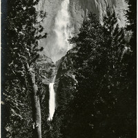
Caption: "Yosemite Falls," c. 1917. Grace McCarthy two unidentified friends pose for a photograph on the trail to Yosemite Falls. Both Upper and Lower Fall can be seen in this photograph. The highest waterfall in Yosemite National Park, Yosemite Falls is made up of two successive cascades falling a total of 2,425 feet from the top of the Upper Fall to the base of the Lower Fall. The Upper Fall alone is 1,430 feet high, and is one of the top twenty highest waterfalls in the world.
Date: 1917
-
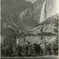
Caption: "Cascade Falls," c. 1917. Erroneously labeled as Cascade Falls, this photograph actually shows both the Upper and Lower Yosemite Falls as viewed from the floor of Yosemite Valley. The highest waterfall in Yosemite National Park, Yosemite Falls is made up of two successive cascades falling a total of 2,425 feet from the top of the Upper Fall to the base of the Lower Fall. The Upper Fall alone is 1,430 feet high, and is one of the top twenty highest waterfalls in the world.
Date: 1917
-
Caption: "Vancouver Hotel, Vancouver, B.C.," c. 1908-1912. View of the Hotel Vancouver, designed by architect T.C. Sorly for the Canadian Pacific Railway (CPR). This photograph shows the first building on the site, which opened in 1888. By 1916, the area had grown so much that the CPR razed this building and constructed a new, larger, more modern facility.
Date: 1908
-
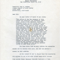
Correspondence from Robert W. Kenny (by H. H. Linney) to Oran W. Palmer regarding taxation of Japanese families during incarceration
Date: April 12, 1943
-
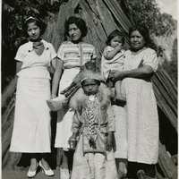
No Caption: An unidentified group of California Indian women and children standing in front of a wigwam covered in tree bark. A young child in front of the group is dressed in traditional clothing.
Date: 1935