Search All Items
- Filters:
- Type
- Image 3891
- Still Image 286
- Text 228
- Text 16
- Language
- English 4317
- Spanish 107
- ENGLISH 1
- census_013 1
Search Results 1521 to 1530 of 4439
-
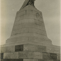
Caption: "Sloat Monument. Monument, Cal," c. 1915, shows the Commodore John Drake Sloat monument in Monterey, California. The monument was constructed in 1910 and commemorates the taking possession of California from Mexico in 1846 by Sloat and his men at Monterey, which was the capital city of Alta California during the Mexican era.
Date: 1915
-
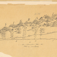
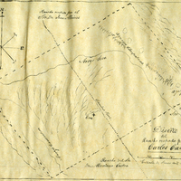
Hand-drawn sketch map of San Francisco de las Llagas boundaries. Volume 1, page 42.
Date: 1833
-
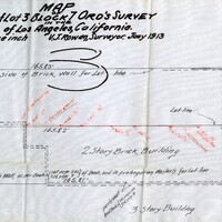
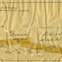
Hand-drawn sketch map of Rancho Del San Juan or San Juan boundaries. Volume 2, page 100.
Date: 1844
-
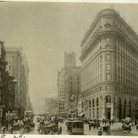
Caption: "Market St. S.F." Shows Market Street with intact buildings, trolleys, horse-drawn buggies and carriages, and people milling about. Most likely before the April 18, 1906 earthquake. C. 1905.
Date: 1905
-
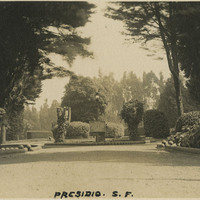
Caption: "Presidio S.F." See also 96-07-08-alb02-021. Entrance to the main post of the Presidio, San Francisco, c. 1910. Established in 1776 by Spanish explorers, the Presidio is a fortified location overlooking the Golden Gate, the entrance into San Francisco Bay. It was closed as a military structure in 1995, and is now a park within the Golden Gate National Recreation Area.
Date: 1910