Search All Items
- Filters:
- Language
- English 4330
- Spanish 107
- ENGLISH 1
- census_013 1
- Type
- Image 3891
- Still Image 286
- Text 236
- Text 19
- Textual 2
Search Results 1571 to 1580 of 4452
-
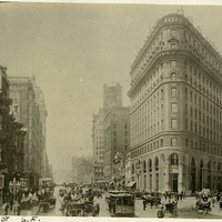
Caption: "Market St. S.F." Shows Market Street with intact buildings, trolleys, horse-drawn buggies and carriages, and people milling about. Most likely before the April 18, 1906 earthquake. C. 1905.
Date: 1905
-
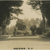
Caption: "Presidio S.F." See also 96-07-08-alb02-021. Entrance to the main post of the Presidio, San Francisco, c. 1910. Established in 1776 by Spanish explorers, the Presidio is a fortified location overlooking the Golden Gate, the entrance into San Francisco Bay. It was closed as a military structure in 1995, and is now a park within the Golden Gate National Recreation Area.
Date: 1910
-
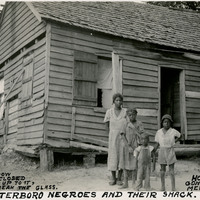
Caption: "Walterboro Negroes and Their Shack. If the Window Wont [sic] Stay Closed, Put a Stick Up to It, You Wont [sic] Break the Glass. House Foundation Gone But They Live Merrily On. July 17, 1934." Unidentified family posing in front of a dilapidated home in Walterboro.
Date: 7/17/1934
-
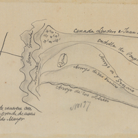
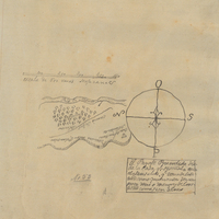
Hand-drawn sketch map of San Francisquito or San Gregorio boundaries. Volume 1, page 526.
Date: 1839
-
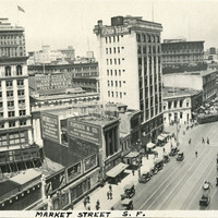
Caption: "Market Street S.F," c. 1935. A bustling Market Street scene with many people, cars and trollies. San Francisco's Ferry Building can be seen in the distance at the far right.
Date: 1935
-
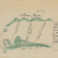
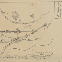
Hand-drawn sketch map of San Bernardo boundaries. Volume 1, page 512.
Date: 1839