Search All Items
- Filters:
- Language
- English 2011
- Spanish 54
- ENGLISH 2
- English 1
- census_013 1
- Type
- Image 1725
- Still Image 163
- Text 153
- Text 22
- Textual 2
Search Results 141 to 150 of 2088
-
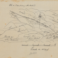
Hand-drawn sketch map of Patrocinio, or Todos Santos y San Antonio boundaries. Volume 1, page 670.
Date: 1840
-
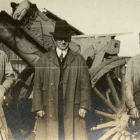
No caption, c. 1917. William McCarthy (center) standing with the unidentified crew of a 6" Howitzer at Camp Kearney. Camp Kearney was established by the U.S. Army in 1917 just north of San Diego. The post was largely abandoned by the government in 1920, used as a military and civilian airfield. It did not see increased military service again until the 1930s.
Date: 1917
-
The Census of 1852 collection includes enumerations of California's 32 counties, arranged into 126 volumes. Schedule I enumerated the county's inhabitants, while schedule II enurmerated economic production. Many pages of this volume are damaged.
Date: 1852
-
Caption: "Sign for California State Parks." Drawing by Alfred Eichler of sign for hacienda of Governor Pio Pico, California State Parks, after design Colonel Wing, Chief Division of Parks. Project for Department of Natural Resources - Beaches and Parks.
Date: 1929