Search All Items
- Filters:
- Language
- English 4767
- Spanish 11
- ENGLISH 2
- English 1
- census_013 1
- contra_costa_schedule_1_volume_1 1
- Type
- Image 3783
- Still Image 592
- Text 377
- Text 22
- Textual 2
- Image of the California Census from the records of the office of the California Secretary of State 1
Search Results 1601 to 1610 of 4830
-
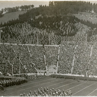
No caption, c. 1930. Football stadium filled with fans for a game, with a marching band on the field at the lower center of the photograph. The stadium is unidentified, but may be University of California, Berkeley's California Memorial Stadium, built in 1923.
Date: 1930
-
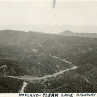
Caption: "Hopland-Clear Lake Highway," c. 1925. Birdseye view of the Hopland Grade (also called the Hopland Pass), now part of California State Route 175 connecting Hopland (Mendocino County) with Lakeport on Clear Lake, in Lake County. The road, built in the early 1920s, is sometimes called the "crookedest road in California."
Date: 1925
-
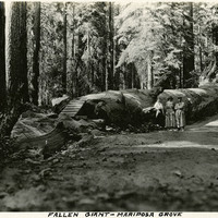
Caption: "Fallen Giant - Mariposa Grove," c. 1917. Grace McCarthy poses with two unidentified people next to the Fallen Monarch, the enormous trunk of a fallen Giant Sequoia in Maripose Grove. It is estimated that the tree fell more than 300 years ago, but the natural resistance of Giant Sequoias to rot has preserved the trunk to the present time.
Date: 1917
-
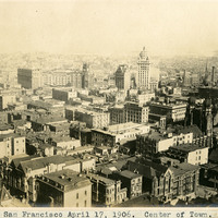
Caption: "San Francisco April 17, 1906. Center of Town." Bird's eye view of the center of San Francisco before the 1906 earthquake and fire. The Call Building (built in the 1890s to house the San Francisco Call newspaper) is the tallest building in the photograph, just to the right of center. See also 96-07-08-alb02-026.
Date: 4/17/1906
-
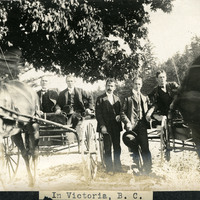
caption: "In Victoria, B. C.," c. 1906. William McCarthy (standing in the center) and four unidentified men with horse-and-buggies in the Gorge. The Gorge is a narrow tidal inlet in Victoria running from Selkirk Trestle to the Craigflower Bridge. The inlet became a popular recreation destination for the area's residents as Victoria grew.
Date: 1906
-
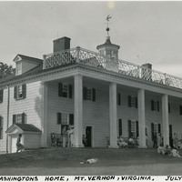
Caption: "George Washingtons [sic] Home, Mt. Vernon, Virginia. July 22, 1934." View of Mount Vernon, the plantation home of George and Martha Washington. Built between 1758 and 1778, the Palladian-style mansion is now owned in trust by the Mount Vernon Ladies' Association and open to the public.
Date: 7/22/1934
-
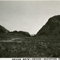
Caption: "Devils Gate -- Nevada -- Elevation 7540 Feet." Devil's Gate is a rock formation near Silver City, Nevada. In the nineteenth century a portion of the formation was blasted away to create enough space for a wagon road, which became a toll road serving as an entryway to the Nevada silver fields.
Date: 1927
-
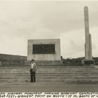
Caption: "Pan-American Highway monument marking the highway completion, July 1, 1936 Altitude 8209 feet. Highest point on route - 15 miles south of Octopan [sic], Mexico." Pictured is William McCarthy standing before the "Monument of Good Friendship (El Monumento de Buena Amistad), near Actopan, Mexico.
Date: 1938
-
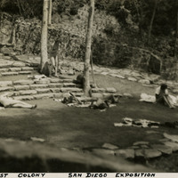
Caption: "Nudist Colony - San Diego Exposition," c. 1935. The Zoro Garden Nudist Colony, named for the Persian mystic, Zoroaster, was an unusual and controversial attraction that featured partially nude men and women performing as nudists. Exposition visitors were charged twenty-five cents to watch the "nudists" perform ceremonies and other activities. Today, the sunken Zoro Garden in Balboa Park is a butterfly garden.
Date: 1935
-
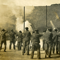
No caption, c. 1910. Large-caliber mortars with associated gun crews at target practice. At least one gun has just been, or is about to be, fired, given that the men are all holding their hands against their ears. See also 96-07-08-alb05-105 and 107.
Date: 1910