Search All Items
- Filters:
- Type
- Image 3891
- Still Image 286
- Text 228
- Text 16
- Language
- English 4317
- Spanish 107
- ENGLISH 1
- census_013 1
Search Results 1631 to 1640 of 4439
-
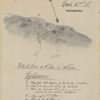
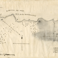
Hand-drawn sketch map of Cañada de los Osos y Pecho y Islae boundaries. Volume 1, page 700.
Date: 1842
-
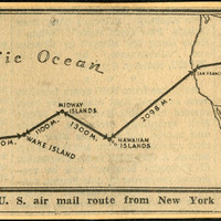
No caption. Clipping from an unidentified newspaper or pamphlet entitled "Route of U.S. air mail route from New York to Macao." It shows an airmail route traveling from New York, west across the U.S. to the Hawaiian Islands, then to "Midway Islands," Wake Island, Guam, "Philippine Islands", and finally Macao, China.
Date: Undated
-
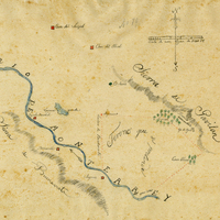
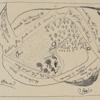
Hand-drawn sketch map of Buena Esperanza boundaries. Volume 1, page 206.
Date: 1833
-
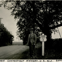
Caption: "Picturesque Connecticut Highway. U.S. No 1. Sept. 4, 1934." William McCarthy standing next to a U.S. Route 1 sign along a tree-lined highway. U.S. Route 1 is a north-south highway connecting the eastern seaboard from Fort Kent, Maine to Key West, Florida.
Date: 9/4/1934
-
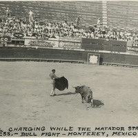
Caption: "The bull charging while the Matador stands motionless. Bull fight - Monterey [sic], Mexico."
Date: 1938
-
This item has no description.
Date: Expediente number 389
-
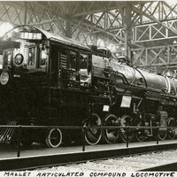
Caption: "Mallet Articulated Compound Locomotive," Panama-Pacific International Exposition.
Date: 1915