Search All Items
- Filters:
- Language
- English 6853
- Spanish 18
- ENGLISH 3
- English 2
- census_013 1
- contra_costa_schedule_1_volume_1 1
- Type
- Image 3886
- Still Image 2484
- Text 441
- Text 54
- Textual 2
- Image of the California Census from the records of the office of the California Secretary of State 1
Search Results 1771 to 1780 of 6969
-
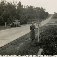
Caption: "Jefferson Davis Highway. U.S. No. 1. Virginia. July 20, 34." Grace McCarthy is standing next to a U.S. Route 1 sign along a highway in Virginia. The Jefferson Davis Highway project was begun by the United Daughters of the Confederacy (UDC). As auto tourism increased across the U.S., so to did the need for roads on which to drive. Private interests such as the UDC began to develop routes across the country, but with no central administrating organization the routes were haphazard and confusing. The UDC planned a route that was to stretch from Virginia across the southern U.S. to San Diego, but the entire route never materialized. The federal government stepped in to impose a numbering system on various routes across the nation. That portion of the planned Jefferson Davis Highway through Virginia was numbered as U.S. Route 1.
Date: 7/20/1934
-
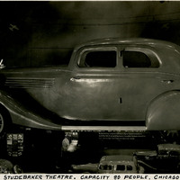
Caption: "Sept. 20, 1934, The Big Studebaker Theatre. Capacity 80 People. Chicago Fair." This giant replica of a 1934 Studebaker Land Cruiser at the Century of Progress Exposition, made of plaster over a wood frame, sat above a small theater capable of sitting eighty people. The Exposition, a world fair attended by thirty-nine million people, celebrated Chicago's one-hundred year anniversary of incorporation. Originally planned to only run from May to November in 1933, it was such a success that its organizers decided to keep it running for a second season from May through October the following year. The central theme of the Exposition was technological innovation, with a motto of "Science Finds, Industry Applies, Man Conforms."
Date: 9/20/1934
-
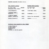
Correspondence from Charles M. Wollenberg (by Bertha S. Underhill) to Margaret Ann Elwell regarding aid for furniture; Attachment: Cost estimations for furniture requested by resettlers
Date: June 1, 1945
-
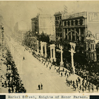
Caption: "Market Street, Knights of Honor Parade," the Knights of Honor were a fraternal and secret society in the United States during the 19th and early 20th century. A Knights of Honor Grand Lodge was established in San Francisco in 1880, and at one time twenty subordinate lodges existed.
Date: Undated