Search All Items
- Filters:
- Language
- English 6853
- Spanish 18
- ENGLISH 3
- English 2
- census_013 1
- contra_costa_schedule_1_volume_1 1
- Type
- Image 3886
- Still Image 2484
- Text 441
- Text 54
- Textual 2
- Image of the California Census from the records of the office of the California Secretary of State 1
Search Results 1811 to 1820 of 6969
-
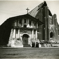
No Caption: Mission Delores, the oldest intact building still standing in San Francisco today, suffered little damage from the 1906 earthquake. The parish church next to it was greatly damaged and rebuilt as the Mission Dolores Basilica, opened in 1918.
Date: 1906
-
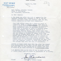
Correspondence from Geo. J. Overholt to Earl Warren regarding potential internment of Japanese at Secret Valley
Date: March 11, 1942
-
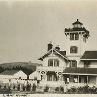
Caption: "Point Firmin [sic] Lighthouse," c. 1915, shows the Point Fermin lighthouse, built in 1874 in San Pedro Bay, which was the first navigational light into the bay. It served as a federally-operated lighthouse until 1927, when its operations were turned over to the City of Los Angeles. After the bombing of Pearl Harbor in 1941, the west coast was blacked out for fear of being an easy target to enemy forces. It was never lit again, but during WWII it served the U.S. Navy as a lookout tower and signaling station for ships coming into the San Pedro Bay. In 2003, the lighthouse was opened after being restored, retrofitted, and rehabilitated for public use. It is listed on the National Register of Historic Places and managed by the Department of Recreation and Parks of the City of Los Angeles.
Date: 1915
-
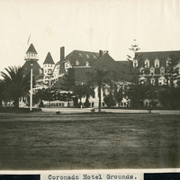
Caption: "Coronado Hotel Grounds.," c. 1910. View of the Coronado Hotel, with landscaped grounds in the foreground. At the time it opened in 1888, this hotel was the largest beach resort in the world. The Ballroom Tower, the highest point of the building, is 120 feet tall.
Date: 1910
-
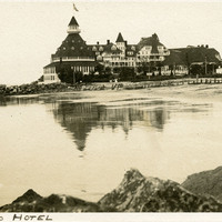
Caption: "Coronado Hotel," c. 1910-1913. The Coronado Hotel, with beach in the foreground. At the time it opened in 1888, this hotel was the largest beach resort in the world. The Ballroom Tower, the highest point of the building, is 120 feet tall. See also 96-07-08-alb08-198.
Date: 1910
-
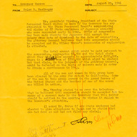
Governor's Office Memorandum from Helen R. MacGregor to Earl Warren regarding reparations for lost salaries
Date: August 29, 1946