Search All Items
- Filters:
- Type
- Image 1138
- Still Image 65
- Text 53
- Text 19
- Language
- English 1246
- Spanish 29
- ENGLISH 1
- English 1
- census_013 1
Search Results 211 to 220 of 1284
-
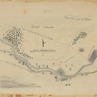
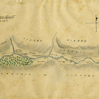
Hand-drawn sketch map of Lomas de la Purification boundaries. Volume 2, page 91.
Date: 1845
-
Hand-drawn sketch map of San Vicente (Bisente) boundaries. Volume 1, page 160.
Date: 1834
-
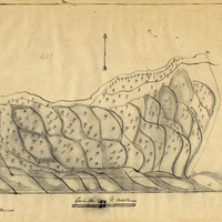
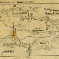
Hand-drawn sketch map of Caligolman or Carne Humana Rancho or Huliac Noma or Colijolmanoc boundaries. Volume 1, page 608.
Date: 1840
-
Hand-drawn sketch map of San Calletano or Sespe boundaries. Volume 1, page 216.
Date: 1829
-
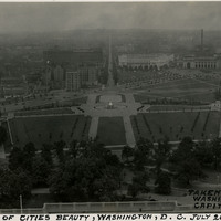
Caption: "Portion of Cities [sic] Beauty, Washington, D.C. July 26, 1934, Taken from Washington Capitol Dome." Bird's eye view of a portion of Washington, D.C., showing Upper and Lower Senate Parks.
Date: 7/25/1934