Search All Items
- Filters:
- Type
- Image 1473
- Still Image 304
- Text 72
- Text 19
- Language
- English 1654
- Spanish 215
- ENGLISH 2
- English 1
- census_013 1
Search Results 221 to 230 of 1881
-
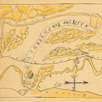
Hand-drawn sketch map of Corral de Tierra, or San Pedro, or San Mateo boundaries. Volume 1, page 4.
Date: 1834
-
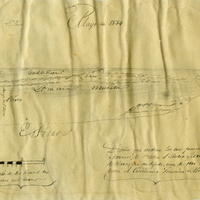
Hand-drawn sketch map of Arroyo de San Antonio boundaries. Volume 2, page 82.
Date: 1844
-
Hand-drawn sketch map of Island of San Diego or Peninsula of San Diego or North Island boundaries. Volume 2, page 193.
Date: 1846
-
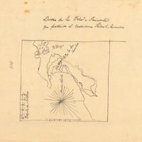
Hand-drawn sketch map of San Miguelito boundaries. Volume 1, page 296.
Date: 1839
-
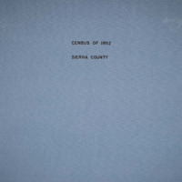
The Census of 1852 collection includes enumerations of California's 32 counties, arranged into 126 volumes. Schedule I enumerated the county's inhabitants, while schedule II enurmerated economic production. Many pages of this volume are damaged.
Date: 1852
-
The Census of 1852 collection includes enumerations of California's 32 counties (at that time), arranged into 126 volumes. Schedule I enumerated the county's inhabitants, while schedule II enurmerated economic production. Many pages of this volume are damaged.
Date: 1852
-
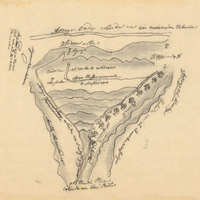
Hand-drawn sketch map of Corte de Madera boundaries. Volume 2, page 60.
Date: 1844