Search All Items
- Filters:
- Type
- Image 1473
- Still Image 304
- Text 72
- Text 19
- Language
- English 1654
- Spanish 215
- ENGLISH 2
- English 1
- census_013 1
Search Results 261 to 270 of 1881
-
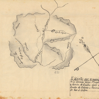
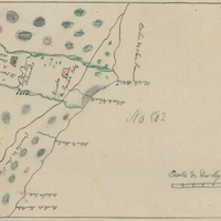
Hand-drawn sketch map of Cañada de los Vaqueros, or Rancho Vasco boundaries. Volume 2, page 115.
Date: 1839
-
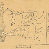
Hand-drawn sketch map of Rinconada de San Leandra or San Leandro boundaries. Volume 2, page 1.
Date: 1840
-
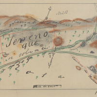
Hand-drawn sketch map of San Miguel or Chisino boundaries. Volume 1, page 572.
Date: 1840
-
Hand-drawn sketch map of Cort de Madera de Novato boundaries. Volume 1, page 484.
Date: 1839