Search All Items
- Filters:
- Type
- Image 3607
- Still Image 935
- Text 401
- Text 19
- Image of the California Census from the records of the office of the California Secretary of State 1
- Language
- English 4940
- Spanish 26
- ENGLISH 2
- English 1
- census_013 1
- contra_costa_schedule_1_volume_1 1
Search Results 3871 to 3880 of 5003
-
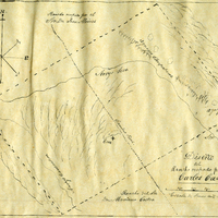
Hand-drawn sketch map of San Francisco de las Llagas boundaries. Volume 1, page 42.
Date: 1833
-
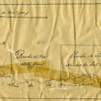
Hand-drawn sketch map of Rancho Del San Juan or San Juan boundaries. Volume 2, page 100.
Date: 1844
-
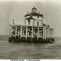
Caption: "Desdamona [sic] Lighthouse.," c. 1905-1909. View of the Desdemona Lighthouse, constructed in 1901 or 1902 on wood pilings over a group of shoals at the mouth of the Columbia River. The shoals carry the same name as the lighthouse, both of which are named for the boat Desdemona which ran aground and was destroyed by the shoals in 1857. The lighthouse was automated in 1934, and its light eventually removed in 1965.
Date: 1905
-
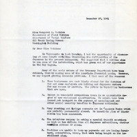
Correspondence from Annie Clo Watson to Martha A. Watkins regarding outline of observed difficulties faced by Japanese
Date: December 27, 1941