Search All Items
- Filters:
- Language
- English 5811
- Spanish 37
- ENGLISH 2
- English 2
- census_013 1
- contra_costa_schedule_1_volume_1 1
- Type
- Image 3877
- Still Image 1473
- Text 439
- Text 54
- Textual 2
- Image of the California Census from the records of the office of the California Secretary of State 1
Search Results 4281 to 4290 of 5921
-
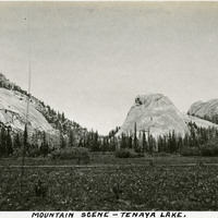
Caption: "Mountain Scene -- Tenaya Lake." Meadow with surrounding rocks and mountains. Named after Chief Tenaya of Yosemite Valley's Ahwahnechee People, Tenaya Lake is located between Yosemite Valley and Tuolumne Meadows within Yosemite National Park. The surface elevation of the alpine lake is 8,150 feet.
Date: 1927
-
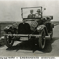
Caption: "Causeway -- Sacramento Highway." William and Grace McCarthy driving over the newly-constructed Yolo Causeway, an elevated stretch of I-80 that connects what is now West Sacramento with Davis by traveling across the Yolo Bypass. The Yolo Causeway's official name is Blecher-Freeman Memorial Causeway.
Date: 1916
-
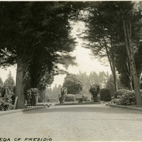
Caption: "The Alameda of Presidio," c. 1910. Established in 1776 by Spanish explorers, the Presidio is a fortified location overlooking the Golden Gate, the entrance into San Francisco Bay. It was closed as a military structure in 1995, and is now a park within the Golden Gate National Recreation Area.
Date: 1910
-
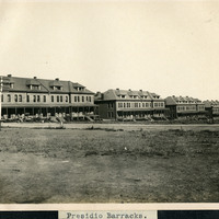
Caption: "Presidio Barracks," c. 1906. Five barrack structures of the Presidio. Established in 1776 by Spanish explorers, the Presidio is a fortified location overlooking the Golden Gate, the entrance into San Francisco Bay. It was closed as a military structure in 1995, and is now a park within the Golden Gate National Recreation Area.
Date: 1906
-
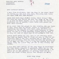
Correspondence from Virginia C. Jones to Earl Warren regarding conditions at the incarceration camps
Date: January 20, 1943