Search All Items
- Filters:
- Type
- Image 3877
- Still Image 1470
- Text 425
- Text 50
- Image of the California Census from the records of the office of the California Secretary of State 1
- Language
- English 5791
- Spanish 37
- ENGLISH 2
- English 2
- census_013 1
- contra_costa_schedule_1_volume_1 1
Search Results 4321 to 4330 of 5886
-
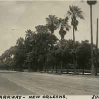
Caption: "City Parkway -- New Orleans. June 16, 34." A row of palm trees interspersed with deciduous trees runs down the middle of this road in New Orleans.
Date: 6/16/1934
-
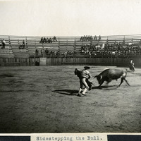
Caption: "Sidestepping the Bull." In this photograph, a bull attempts to gore a matador holding a cape, observed by dozens of people in the surrounding stands.
Date: 1905
-
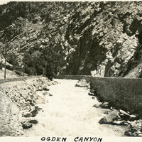
Caption: "Ogden Canyon," c. 1915-1920. Railroad tracks and a raised roadbed (with stone retaining wall) bracket Ogden Creek in this image, surrounded by steep, rocky canyon walls.
Date: 1915
-
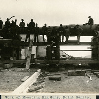
Caption: "Work of Mounting Big Guns, Point Benito [sic]," c. 1906. This may actually be Point Bonita in the San Francisco Bay.
Date: 1906
-
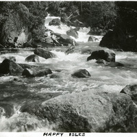
Caption: "Happy Isles," c. 1917. The Merced River tumbles over rocks and around several small isles in this photograph. The isles are collectively known as the Happy Isles.
Date: 1917
-
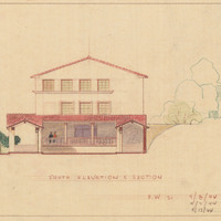
Caption: "South Elevation and Section." Color drawing of postwar building, California School for the Deaf at Berkeley. Design and drawing by Alfred Eichler, 1944; built in 1946. Project for Department of Education.
Date: 1944