Search All Items
- Filters:
- Language
- English 7210
- Spanish 43
- ENGLISH 3
- English 2
- census_013 1
- contra_costa_schedule_1_volume_1 1
- Type
- Image 3888
- Still Image 2860
- Text 445
- Text 54
- Textual 2
- Image of the California Census from the records of the office of the California Secretary of State 1
Search Results 4671 to 4680 of 7358
-
Image withheld due to copyright considerations. For more information, please contact the California State Archives Reference Desk at ArchivesWeb@sos.ca.gov or (916) 653-2246. Image is a map of the United States showing "Our 1934 United States Automobile Tour. Traveled 10,000 miles -- May 14 to Oct 9.th. Note the Blue Line for Route of Travel." The blue line stretches from San Francisco to Los Angeles, then along the southern portion of the U.S. into Florida, south to Havana, and then north along the East Coast until heading east from Boston. The route skirted the Great Lakes then struck out across the Great Plains, Colorado, and Nevada, before ending in San Francisco to complete the loop.
Date: 1934
-
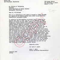
Correspondence from Azile H. Aaron to Charles M. Wollenberg regarding using resettlement assistance funds to purchase garden tools
Date: August 8, 1945
-
Caption: "Prado or Promenade -- Havana -- Cub. July 4, 1934." Street scene, with a wide street lined with marble benches and trees on both sides. The Paseo del Prado is the oldest paved street in Havana, marking the line between Centro Habana and Old Havana. Its route was established in 1772 by Don Felipe Fonsdeviela y Ondeano. The street was redesigned in 1925 by landscape architect Jean-Claude Nicolas Forestier (who added the trees and marble benches).
Date: 7/4/1934
-
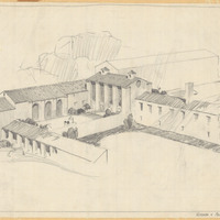
Caption: "Kitchen & Primary Dining Room. Cal. School for Deaf." design and drawing by Alfred Eichler. Built. Project for Department of Education.
Date: 1930