Search All Items
- Filters:
- Type
- Image 3882
- Still Image 2091
- Text 431
- Text 50
- Image of the California Census from the records of the office of the California Secretary of State 1
- Language
- English 6437
- Spanish 23
- ENGLISH 2
- English 2
- census_013 1
- contra_costa_schedule_1_volume_1 1
Search Results 4741 to 4750 of 6524
-
Caption: "Spanish Type Home -- Key West. July 2, 1934." View of a multi-story residence in Key West. Much of the building is obscured by surrounding vegetation.
Date: 7/2/1934
-
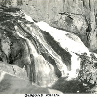
Caption: "Gibbons Falls," c. 1923. Yellowstone National Park's Gibbon Falls is located on the Gibbon River. The falls drop roughly eighty-four feet in a gradual descent.
Date: 1923
-
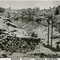
Caption: "Sierra Summit -- Truckee Highway." Mountain scene, showing roadway with car in center of photograph. Likely along what is now Interstate 80.
Date: 1927
-
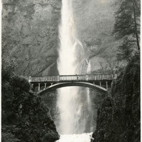
No caption, c. 1920. Waterfall with lush vegetation along the Columbia River in Oregon. The Benson Footbridge, built in 1914, is featured at the center of the photograph.
Date: 1920
-
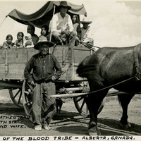
Caption: "Indians of the Blood Tribe - Alberta, Canada. The Grandfather, and his son, with six children and wife," c. 1935, shows the Blood Indian family riding in a horse-drawn wagon.
Date: 1935
-
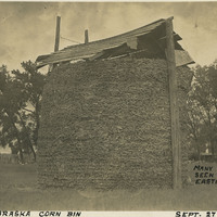
Caption: "A Nebraska Corn Bin, Many of These are Seen in Iowa and Eastern Nebraska. Sept. 27, 1934." A simple corn crib in Nebraska, where the corn ears are contained by wire fencing and sheltered by a gabled roof.
Date: 9/27/1934
-
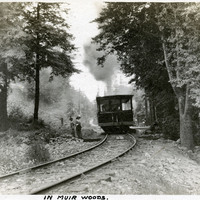
Caption: "In Muir Woods.," c. 1906. Grace McCarthy (in hat with white feather) and an unidentified woman standing at a small platform along a railroad in Muir Woods, being passed by a train car. This was likely part of the Mount Tamalpais and Muir Woods Railway, established in 1896 as a scenic tourist railway between Mill Valley and the east peak of Mt. Tamalpais in Marin County. See also 96-07-08-alb05-017.
Date: 1906
-
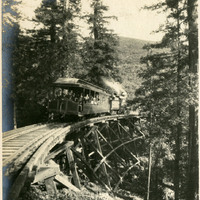
Caption: "Canyon and Trestle Mt Tamalpais RR.," c. 1907. Muir Woods Railway, established in 1896 as a scenic tourist railway between Mill Valley and the east peak of Mount Tamalpais in Marin County.
Date: 1907
-
Image withheld due to copyright considerations. For more information, please contact the California State Archives Reference Desk at ArchivesWeb@sos.ca.gov or (916) 653-2246. Image is a map of the United States showing "Our 1934 United States Automobile Tour. Traveled 10,000 miles -- May 14 to Oct 9.th. Note the Blue Line for Route of Travel." The blue line stretches from San Francisco to Los Angeles, then along the southern portion of the U.S. into Florida, south to Havana, and then north along the East Coast until heading east from Boston. The route skirted the Great Lakes then struck out across the Great Plains, Colorado, and Nevada, before ending in San Francisco to complete the loop.
Date: 1934