Search All Items
- Filters:
- Type
- Image 1312
- Still Image 275
- Text 176
- Text 19
- Language
- English 1628
- Spanish 154
- ENGLISH 2
- English 1
- census_013 1
Search Results 31 to 40 of 1804
-
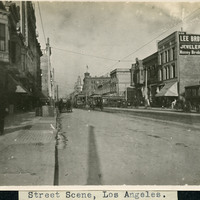
Caption: "Street Scene, Los Angeles," c. 1908. A view of an early twentieth street scene in Los Angeles, with horse-drawn vehicles, trolley cars, and numerous buildings.
Date: 1908
-
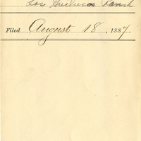
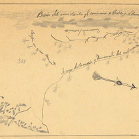
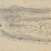
Hand-drawn sketch map of Llamitos de los Correos or Guadalupe y Llamitos de los Correos or Chular boundaries. Volume 1, page 48.
Date: 1831
-
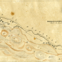
Caption: "Echo Park [sic] -- Los Angeles," c. 1910. Grace McCarthy standing on a bridge in Los Angeles' Echo Lake Park. The park opened in 1895. The lake was originally created in 1868 to support the operations of a mill. The mill, however, closed seven years later. The site was later selected for conversion to a city park.
Date: 1910
-
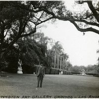
Caption: "Huntington Art Gallery Grounds-Los Angeles," c. 1935, shows William McCarthy standing in the gardens of the Huntington Art Gallery in San Marino, Los Angeles County.
Date: 1935
-
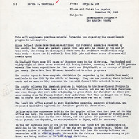
Correspondence from Beryl E. Cox to Bertha S. Underhill regarding report on resettlement program and the use of public assistance
Date: November 29, 1945
-
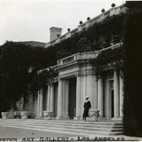
Caption: "Huntington Art Gallery- Los Angeles," c. 1935, shows Grace McCarthy standing before the Huntington Art Gallery building in San Marino, Los Angeles County.
Date: 1935
-
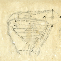
Hand-drawn sketch map of Potrero de los Cerritos boundaries. Volume 2, page 50.
Date: 1840
-
Hand-drawn sketch map of Cañada de los Capotancillos or San Vicente or San Jose Pueblo boundaries. Volume 1, page 770.
Date: 1842
-
Hand-drawn sketch map of Cañada del Cort de Madera, or San Emilio, (Emiglio), or Todos Santos boundaries. Volume 1, page 12.
Date: 1833