Search All Items
- Filters:
- Language
- English 5811
- Spanish 37
- ENGLISH 2
- English 2
- census_013 1
- contra_costa_schedule_1_volume_1 1
- Type
- Image 3877
- Still Image 1473
- Text 439
- Text 54
- Textual 2
- Image of the California Census from the records of the office of the California Secretary of State 1
Search Results 5471 to 5480 of 5921
-
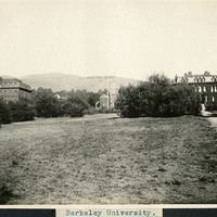
Caption: "Berkeley University," c. 1906. Founded in 1868, the University of California at Berkeley was the first of the University of California campuses. This image shows a field of grass and trees in the foreground, three unidentified university buildings in the background, and the Berkeley Hills in the distance.
Date: 1906
-
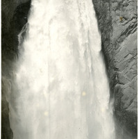
Caption: "Lower Falls," c. 1923. As the Yellowstone River flows north from Yellowstone Lake it passes over two waterfalls (Upper and Lower Yellowstone Falls) before reaching the Yellowstone Grand Canyon. This photograph shows the 308-foot Lower Yellowstone Falls, as viewed from the base of the falls. It carries more water volume than any other waterfall in the Rocky Mountains.
Date: 1923
-
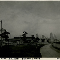
Caption: "Longfellow Bridge, Boston, Mass. Sept. 5, 1934." The Longfellow Bridge spans the Charles River between Boston and Cambridge. Originally called the Cambridge Bridge, it replaced a wood structure called the West Boston Bridge that had been constructed in 1793. This wood bridge was unable to handle large volumes of traffic or the introduction of street cars, so a new bridge was built in the early twentieth century. Opened in 1906 as the Cambridge Bridge, the name was changed in 1927 to the Longfellow Bridge in honor of poet Henry Wadsworth Longfellow. It is colloquially known as the Salt and Pepper Bridge, as its central towers are reminiscent in shape of salt and pepper shakers.
Date: 9/5/1934
-
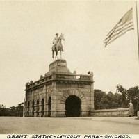
Caption: "Grant Statue - Lincoln Park - Chicago," c. 1923. Installed in 1891, the Ulysses S. Grant Memorial, created by Louis Rebisso (sculptor), is located in the east end of Chicago's Lincoln Park Zoo. It commemorates Ulysses S. Grant, former U.S. Army General and 18th President of the U.S.
Date: 1923
-
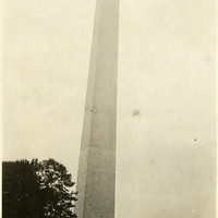
Caption: "Washington Monument," c. 1920. Built between 1848 and 1888 to commemorate George Washington (former Commander-in-Chief of the Continental Army and first President of the United States), the obelisk is the world's tallest stone structure at a height of 555 feet. See also 96-07-08-alb09-212.
Date: 1920
-
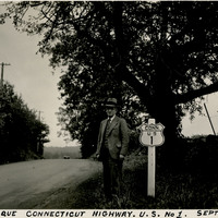
Caption: "Picturesque Connecticut Highway. U.S. No 1. Sept. 4, 1934." William McCarthy standing next to a U.S. Route 1 sign along a tree-lined highway. U.S. Route 1 is a north-south highway connecting the eastern seaboard from Fort Kent, Maine to Key West, Florida.
Date: 9/4/1934
-
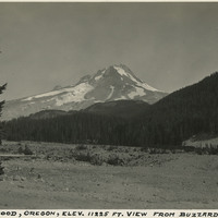
Caption: "Mount Hood, Oregon, Elev. 11225 ft. View from Buzzard Point," c. 1935. Mount Hood is a potentially active volcano in the Cascade Volcanic Arc of the Cascade Range in the Clackamas and Hood River counties of northern Oregon. The last eruption of Mount Hood was in 1907.
Date: 1935
-
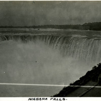
Caption: "Niagara Falls," c. 1925. View of Horseshoe Falls, largest of the three waterfalls that make up the iconic Niagara Falls straddling the border between Ontario, Canada, and the State of New York. At the right side of the photograph is a parking area with groups of tourists taking in the view.
Date: 1925
-
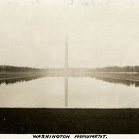
Caption: "Washington Monument," c.1925. The obelisk of the Washington Monument rises above the Reflecting Pool on National Mall in Washington, D.C. Built between 1848 and 1888 to commemorate George Washington (former Commander-in-Chief of the Continental Army and first President of the United States), the obelisk is the world's tallest stone structure at a height of 555 feet.
Date: 1925
-
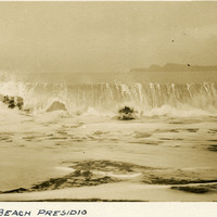
Caption: "Bakers [sic] Beach Presidio," c. 1906. Breaking ocean wave at Baker Beach. The beach is located on the Pacific Ocean, west and south of Golden Gate Point (the northern tip of the San Francisco Peninsula) within the boundaries of the Presidio of San Francisco.
Date: 1906