Search All Items
- Filters:
- Language
- English 5811
- Spanish 37
- ENGLISH 2
- English 2
- census_013 1
- contra_costa_schedule_1_volume_1 1
- Type
- Image 3877
- Still Image 1473
- Text 439
- Text 54
- Textual 2
- Image of the California Census from the records of the office of the California Secretary of State 1
Search Results 5751 to 5760 of 5921
-
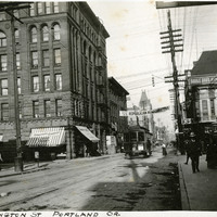
Caption: "Washington Street, Portland, Oregon," c. 1905. A street scene with electric car, several storefronts, and pedestrians milling about.
Date: 1905
-
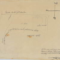
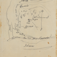
Hand-drawn sketch map of Sayent or Zaygente or Zayanta boundaries. Volume 1, page 194.
Date: 1833
-
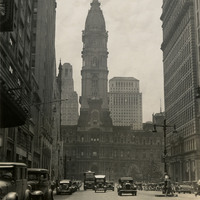
Caption: "City Hall, Broad St. Philadelphia, PA. July 31, 1934." Street scene along Broad Street in Philadelphia, with the City Hall building visible in the middle of the photograph. Philadelphia's City Hall was built in 1901, designed by architect John McArthur, Jr. At completion, the building was the world's tallest inhabitable structure. It is the largest municipal building in the world, with almost 700 rooms. A 37-foot-tall statute of William Penn (founder of Philadelphia) adorns the peak of the structure, created by Alexander Milne Calder.
Date: 7/31/1934
-
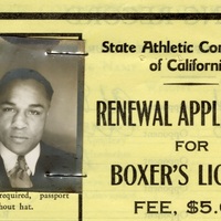
This item has no description.
Date: undated
-
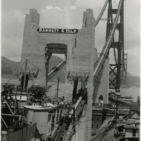
Caption: "Golden Gate Bridge, Construction, July 1, 1936." Image of one terminus of the Golden Gate Bridge, showing the anchoring site of the suspension wires. Completed in 1937, the Golden Gate Bridge spans the mouth of San Francisco Bay (called the Golden Gate), connecting San Francisco with Marin County to the north. It is one of the most recognizable bridges in the world, and was named in 1994 as one of the Modern Wonders of the World by the American Society of Civil Engineers.
Date: 7/1/1936
-
Hand-drawn sketch map of Bolsa de los Rodrigues boundaries. Volume 1, page 232.
Date: 1836