Search All Items
- Filters:
- Type
- Image 3871
- Still Image 1541
- Text 433
- Text 19
- Image of the California Census from the records of the office of the California Secretary of State 1
- Language
- English 5808
- Spanish 62
- ENGLISH 2
- English 1
- census_013 1
- contra_costa_schedule_1_volume_1 1
Search Results 5791 to 5800 of 5946
-
Caption: "Sutters [sic] Fort - Sacramento," c. 1920, shows a gun tower at Sutter's Fort, and a gate bracketed by two cannons. John Sutter established the fort in 1839, calling it New Helvetia. After the discovery of gold at one of Sutter's mills (at Coloma, on the American River), almost all of the fort's inhabitants left for the gold fields in the foothills. The fort deteriorated until being restored from 1891-1893. The Native Sons of the Golden West were influential in the restoration. The fort is now the site of a State Historic Park. See also 96-07-08-alb05-117 and 118.
Date: 1920
-
Image of Census of 1852, page 14 from Placer County Schedule I Volume I.
Date: 1852
-
Caption: "First Apt. House in America -- New Orleans -- Jun 16, 34." One of the Pontalba Buildings occupies the right side of this photograph. These large, matching, red brick buildings, constructed in the late 1840s by Baroness Micaela Almonester Pontalba, form two sides of Jackson Square in New Orleans' French Quarter. Popular belief holds that these are the oldest continuously-rented apartment buildings in the U.S. However, that assertion has been challenged by historians who state that the buildings served as row houses for almost a century, not functioning as apartment buildings until the 1930s.
Date: 6/16/1934
-
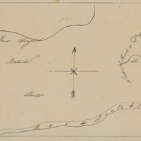
Hand-drawn sketch map of San Bernadino boundaries. Volume 1, page 738.
Date: 1840
-
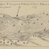
Hand-drawn sketch map of Najoque or Nojoguez boundaries. Volume 2, page 79.
Date: 1842