Search All Items
- Filters:
- Language
- English 6020
- Spanish 194
- ENGLISH 2
- English 1
- census_013 1
- Type
- Image 3854
- Still Image 1909
- Text 426
- Text 22
- Textual 2
Search Results 5821 to 5830 of 6281
-
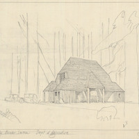
Caption: "Crescent City Border Station. Dept. of Agriculture." Sketch of plant quarantine inspection station. Design and drawing by Alfred Eichler. Built in 1936. Project for Department of Agriculture.
Date: 1931
-
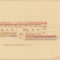
Caption: "Kindergarten Unit. West Elevation." Color drawing of California School for the Deaf at Berkeley. Design and drawing by Alfred Eichler, 1944; built in 1946. Project for Department of Education.
Date: 1944
-
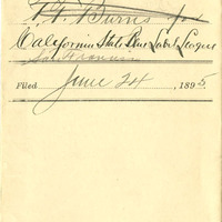
California Cigar Makers, For the Protection of Home Industry
Date: 1895
-
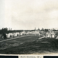
Caption: "Fort Stevens, Or.," c. 1910. View of buildings at Fort Stevens, part of the Three Fort Harbor Defense System protecting the mouth of the Columbia River from enemy incursion or attack (the other forts being Fort Columbia and Fort Canby, both in Washington). Built during the Civil War, the fort remained active until after World War II. In June 1942, Fort Stevens gained the dubious distinction of being the only military installation in the continental United States to come under enemy fire when a Japanese submarine surfaced off the coast and fired seventeen missiles at the fort. The missiles destroyed the backstop to the fort's baseball field, but otherwise did little harm. Fort Stevens was decommissioned in 1947. It was later turned over to the Oregon Parks and Recreation Department, and currently is the site of an Oregon State Park.
Date: 1910
-
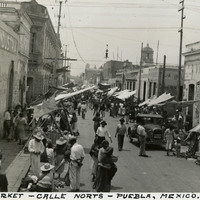
Caption: "Street Market - Calle Norts - Puebla, Mexico."
Date: 1938
-
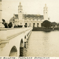
Caption: "Government Building. Portland Exposition." Shows the Government Building, Guild's Lake, and the Bridge of Nations, a long pedestrian bridge over the lake. Some of the more than 100,000 light bulbs used to outline the exposition's buildings can be seen along the arches and decorative molding of the bridge. The Lewis and Clark Centennial Exposition was held in Portland, Oregon from June 1st to October 15th, 1905. It celebrated the one-hundred year anniversary of the exploratory expedition of the Louisiana Purchase and what became the northwestern part of the United States, led by Meriwether Lewis and William Clark. Some 1.6 million people visited the fair, viewing exhibits from twenty-one countries. See also 96-07-08-alb08-158.
Date: 1905