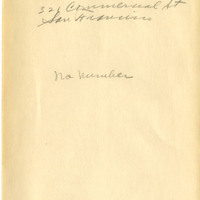
Note: Check the about page for more information on the data sources used in this search
Blue Grass
Date: 1872
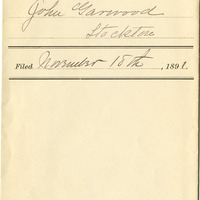
Kangovan
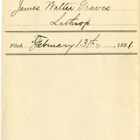
Date: 1891
Columbian Brand
Date: 1893
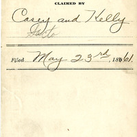
[Blue mark painted on bottle]
Date: 1861
Münchener Beer, Special Brew
Date: 1894
Coutry
Date: 1869
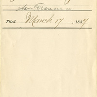
United States Divorce Bureau
Date: 1887
Infallible Colic and Inflamation Medicine
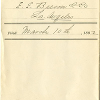
Los Angeles Canning Co.
Date: 1892
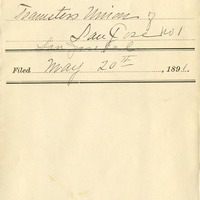
T. U.