Search All Items
- Filters:
- Language
- English 5827
- Spanish 62
- ENGLISH 2
- English 1
- census_013 1
- contra_costa_schedule_1_volume_1 1
- Type
- Image 3871
- Still Image 1544
- Text 447
- Text 22
- Textual 2
- Image of the California Census from the records of the office of the California Secretary of State 1
Search Results 5831 to 5840 of 5968
-
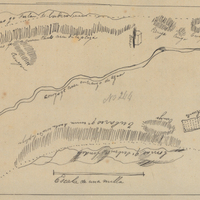
Hand-drawn sketch map of La Bolsa Chica boundaries. Volume 1, page 656.
Date: 1839
-
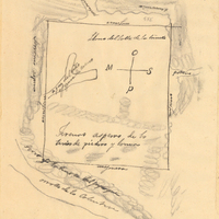
Hand-drawn sketch map of Valle de la Trinidad boundaries. Volume 2, page 194.
Date: 1846
-
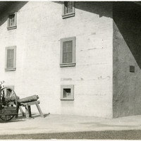
No Caption: c. 1920. Image of the main building of Sutter's Fort. John Sutter established the fort in 1839, calling it New Helvetia. After the discovery of gold at one of Sutter's mills (at Coloma, on the American River), almost all of the fort's inhabitants left for the gold fields in the foothills. The fort deteriorated until being restored from 1891-1893. The Native Sons of the Golden West were influential in the restoration. The fort is now the site of a State Historic Park. See also 96-07-08-alb05-117 and 118.
Date: 1920
-
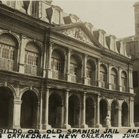
Caption: "Cabildo or Old Spanish Jail and St. Louis Cathedral -- New Orleans, June 16, 34." The façade of the Cabildo dominates this photograph, while the corner of St. Louis Cathedral is visible at the right. The Cabildo was the seat of government for New Orleans while the area was under Spanish jurisdiction. The building was also the site of the transfer ceremonies when the U.S. purchased the Louisiana Territory from France in 1803. Although damaged by fire in 1988, the restored Cabildo survived Hurricane Katrina in 2005 with only minor damage.
Date: 6/16/1934
-
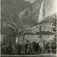
Caption: "Cascade Falls," c. 1917. Erroneously labeled as Cascade Falls, this photograph actually shows both the Upper and Lower Yosemite Falls as viewed from the floor of Yosemite Valley. The highest waterfall in Yosemite National Park, Yosemite Falls is made up of two successive cascades falling a total of 2,425 feet from the top of the Upper Fall to the base of the Lower Fall. The Upper Fall alone is 1,430 feet high, and is one of the top twenty highest waterfalls in the world.
Date: 1917
-
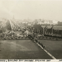
Caption: "San Francisco, Oakland Bay Bridge. Opening Day, Nov. 12, 1936." View of a portion of the ceremonies officially opening the San Francisco-Oakland Bay Bridge to traffic upon its completion in November 1936. The Bay Bridge's design combined three different types of bridge-building technology over the five miles it covers between San Francisco and Oakland: a suspension span, a cantilevered span, and a tunnel. At the time of its completion the bridge was the longest steel structure on the globe. It also featured the deepest bridge pier ever built, and the world's largest bore tunnel.
Date: 11/12/1936
-
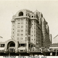
Caption: "Traymore Hotel - Atlantic City," c. 1925. View of the Traymore Hotel on the Atlantic City Boardwalk. The Art Deco-style Traymore began as a small boarding house, but a rebuild and enlargement after a storm in 1884 led to the building becoming Atlantic City's most popular hotel by the turn of the twentieth century. In 1906 the front tower was constructed, and the back, wood frame portion of the hotel was replaced with a concrete structure in 1914-1915. Patronage declined in the 1960s, and the Traymore Hotel was demolished in 1972.
Date: 1925