Search All Items
- Filters:
- Language
- English 5811
- Spanish 37
- ENGLISH 2
- English 2
- census_013 1
- contra_costa_schedule_1_volume_1 1
- Type
- Image 3877
- Still Image 1473
- Text 439
- Text 54
- Textual 2
- Image of the California Census from the records of the office of the California Secretary of State 1
Search Results 5841 to 5850 of 5921
-
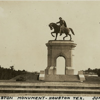
Caption: "Sam Houston Monument -- Houston Tex. June 8, 34." View of the San Houston Monument, a twenty-foot-tall bronze sculpture designed by Enrico Cerracchio and dedicated in 1925. The sculpture commemorates Sam Houston, a prominent soldier and politician who served as the first and third President of the Republic of Texas before its annexation to the U.S. Houston also served as Governor of Texas and as a U.S. Senator for both Texas and Tennessee.
Date: 6/8/1934
-
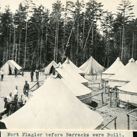
Caption: "Fort Flagler before Barracks were Built.," c. 1899-1906. The coastal artillery fortification Fort Flagler was established in 1897 and activated in 1899. Most of the fort's buildings and batteries had been completed by 1907. Fort Flagler was part of the "triangle of fire," three coastal defense fortifications (Fort Casey, Fort Worden, and Fort Flagler) guarding the entrance to Puget Sound. Fort Flagler was decommissioned in 1953, and purchased by the State of Washington in 1955 for use as a state park.
Date: 1899
-
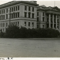
Caption: "S.P. Hospital, S.F.," c. 1910. Constructed in 1908 and designed by architect Daniel J. Patterson, the hospital treated Southern Pacific Railroad workers from across the American West, as well as passengers injured while riding. As the twentieth century progressed and automobiles supplanted trains as the premier method of transportation for people and goods, the hospital entered a period of decline, closing in 1974. It has since been renovated and now serves as a senior housing complex.
Date: 1910
-
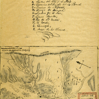
Hand-drawn sketch map of Huasna or Ex-Mission of San Luis Obispo boundaries. Volume 2, page 15.
Date: 1843
-
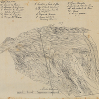
Hand-drawn sketch map of Corral de Piedra boundaries. Volume 1, page 640.
Date: 1839
-
All Points Bulletin from Earl Warren to District Attorneys and Sheriffs regarding survey of alien land ownership and conference
Date: January 23, 1942
-
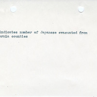
Map indicating number of Japanese removed from various counties in California
Date: Undated