Search All Items
- Filters:
- Language
- English 5827
- Spanish 62
- ENGLISH 2
- English 1
- census_013 1
- contra_costa_schedule_1_volume_1 1
- Type
- Image 3871
- Still Image 1544
- Text 447
- Text 22
- Textual 2
- Image of the California Census from the records of the office of the California Secretary of State 1
Search Results 5871 to 5880 of 5968
-
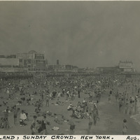
Caption: "Coney Island, Sunday Crowd. New York. Aug. 19, 1934." Very crowded beach scene on New York's Coney Island. The construction of several resort hotels on the island in the 1870s and 1880s encouraged construction of amusement parks to provide tourist destinations. Coney Island has hosted several large amusement parks over the years, including one of the world's first roller coasters (built in 1884). Numerous smaller attractions were available as well. The island's popularity peaked in the World War II era, but despite some decline is still a world-renowned recreation area.
Date: 8/19/1934
-
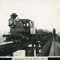
Caption: "Columbia River Jetty, Or.," c. 1910. View of a jetty built at the mouth of the Columbia River, carrying a railroad trestle. A train and its operators, hauling cars loaded with large rocks, dominates the photograph. This is likely the so-called South Jetty, extending more than six miles into the ocean from Point Adams on the Oregon side of the river mouth. The jetty system at the mouth of the Columbia River was constructed between 1885 and 1917. Designed to funnel water from the Columbia River in a more concentrated fashion into the Pacific Ocean, the jetty system helped create a deeper, more stable shipping channel.
Date: 1910
-
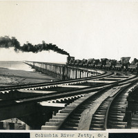
Caption: "Columbia River Jetty, Or.," c. 1910. View of a jetty built at the mouth of the Columbia River, carrying a railroad trestle. A train hauling cars loaded with large rocks is steaming away from the photographer. This is likely the so-called South Jetty, extending more than six miles into the ocean from Point Adams on the Oregon side of the river mouth. The jetty system at the mouth of the Columbia River was constructed between 1885 and 1917. Designed to funnel water from the Columbia River in a more concentrated fashion into the Pacific Ocean, the jetty system helped create a deeper, more stable shipping channel.
Date: 1910
-
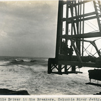
Caption: "Pile Driver in the Breakers, Columbia River Jetty.," c. 1910. View of a large pile driver used in the construction of the jetty system at the mouth of the Columbia River. This is likely at the end of the so-called South Jetty, extending more than six miles into the ocean from Point Adams on the Oregon side of the river mouth. The jetty system at the mouth of the Columbia River was constructed between 1885 and 1917. Designed to funnel water from the Columbia River in a more concentrated fashion into the Pacific Ocean, the jetty system helped create a deeper, more stable shipping channel.
Date: 1910
-
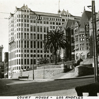
Caption: "Court House - Los Angeles." c. 1915-1920. The Los Angeles County Courthouse, also known as the Red Sandstone Courthouse, was completed in 1891. Located at the southeast corner of Temple and Broadway, the courthouse was damaged beyond repair by the 1933 Long Beach earthquake and demolished in 1936. To the left of the courthouse stands the Hall of Records, built in 1911 and used, along with other buildings, as the county courthouse from 1934 until 1959, when the current courthouse was occupied. The Hall of Records was demolished in 1973.
Date: 1915
-
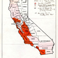
Map of California indicating areas under different stages of the incarceration
Date: May 18, 1942
-
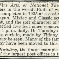
No Caption: A section of an informational tourist brochure describing the Palace of Fine Arts, or National Theater in Mexico City.
Date: 1938