Search All Items
- Filters:
- Type
- Image 3854
- Still Image 1906
- Text 414
- Text 19
- Language
- English 6003
- Spanish 194
- ENGLISH 2
- English 1
- census_013 1
Search Results 5981 to 5990 of 6261
-
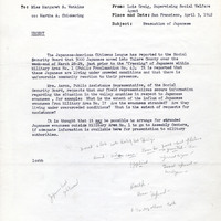
Office Memorandum from Lois Craig to Margaret S. Watkins regarding incarceration
Date: April 3, 1942
-
Office Memorandum from Doris Todd to Genevieve Murrican regarding the number of telephone inquiries for information
Date: February 9, 1942
-
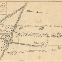
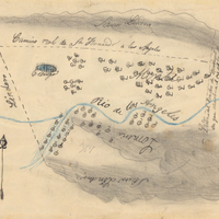
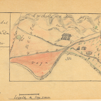
Hand-drawn sketch map of Ojo de Caballo, or Posolmi Rancho and Posita de las Animas boundaries. Volume 2, page 108.
Date: 1843
-
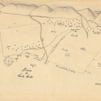
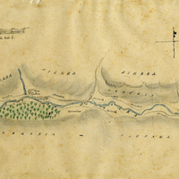
Hand-drawn sketch map of San Calletano or Sespe boundaries. Volume 1, page 216.
Date: 1829