Search All Items
- Filters:
- Type
- Image 3854
- Still Image 1906
- Text 414
- Text 19
- Language
- English 6003
- Spanish 194
- ENGLISH 2
- English 1
- census_013 1
Search Results 5991 to 6000 of 6261
-
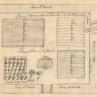
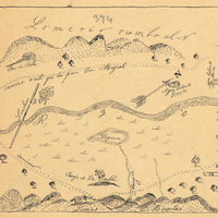
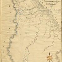
Hand-drawn sketch map of Cañada de los Vaqueros, or Rancho Vasco boundaries. Volume 2, page 115.
Date: 1839
-
Caption: "Government Exhibit -- Portland Exposition." Exhibit of various types of heavy ordnance shells, including armor piercing shells as well as torpedoes. The exhibit was located in the Government Building of the Lewis and Clark Centennial Exposition, held in Portland, Oregon from June 1st to October 15th, 1905. It celebrated the one-hundred year anniversary of the exploratory expedition of the Louisiana Purchase and what became the northwestern part of the United States, led by Meriwether Lewis and William Clark. Some 1.6 million people visited the fair, viewing exhibits from twenty-one countries. See also 96-07-08-alb08-159.
Date: 1905
-
Hand-drawn sketch map of Estero Americano or Cañada de Mais boundaries. Volume 1, page 450.
Date: 1837
-
Caption: "Fort Casey Light House [sic]," c. 1905. Located on Whidbey Island in Puget Sound, the Admiralty Head Lighthouse was built overlooking Admiralty Inlet in 1903. It replaced an earlier structure that had to be moved in 1890 to accommodate the construction of Fort Casey. The second lighthouse, shown here, was built with thick walls in order to withstand earthquakes and the concussion of guns at the fort. The man and woman shown in the photograph (standing with a dog) are likely Charles H. Davis and his second wife Delia (Overton) Davis. Charles Davis was appointed keeper of the lighthouse in 1900 and served until his death in 1914. The lighthouse, deactivated in 1922, has since been restored by Washington State Parks, and is part of the Fort Casey State Park. See also 96-07-08-alb02-057.
Date: 1905