Search All Items
- Filters:
- Type
- Image 3882
- Still Image 2091
- Text 431
- Text 50
- Image of the California Census from the records of the office of the California Secretary of State 1
- Language
- English 6437
- Spanish 23
- ENGLISH 2
- English 2
- census_013 1
- contra_costa_schedule_1_volume_1 1
Search Results 6071 to 6080 of 6524
-
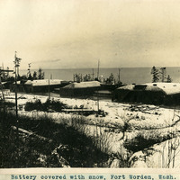
Caption: "Battery covered with snow, Fort Worden, Wash.," c. 1908-1912. Shows the three batteries at Fort Worden covered in a blanket of snow, with the ocean or Puget Sound in the distance. Construction began on the fort in 1898, and by 1902 it was serving as an active U.S. Army base. Fort Worden was part of the "triangle of fire," three coastal defense fortifications (Fort Casey, Fort Worden, and Fort Flagler) guarding the entrance to Puget Sound. The U.S. sold the property to the state of Washington in 1957. In 1973, the fort and surrounding area opened as Fort Worden State Park.
Date: 1908
-
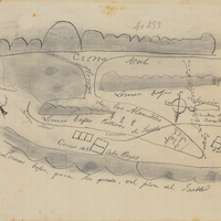
Hand-drawn sketch map of Cañada de los Capotancillos or San Vicente or San Jose Pueblo boundaries. Volume 1, page 770.
Date: 1842
-
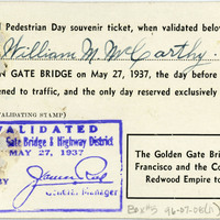
No caption. Reverse of a souvenir ticket for the "Official Pedestrian Day" on May 27, 1937, held as part of the Golden Gate Bridge Fiesta celebrating the opening of the now-iconic bridge. The celebrations occupied an entire week, kicked off by Pedestrian Day, when more 200,000 people were allowed to walk across the Golden Gate Bridge on foot or on roller skates, the day before the bridge opened for vehicular traffic.
Date: 5/27/1937
-
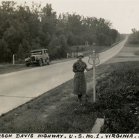
Caption: "Jefferson Davis Highway. U.S. No. 1. Virginia. July 20, 34." Grace McCarthy is standing next to a U.S. Route 1 sign along a highway in Virginia. The Jefferson Davis Highway project was begun by the United Daughters of the Confederacy (UDC). As auto tourism increased across the U.S., so to did the need for roads on which to drive. Private interests such as the UDC began to develop routes across the country, but with no central administrating organization the routes were haphazard and confusing. The UDC planned a route that was to stretch from Virginia across the southern U.S. to San Diego, but the entire route never materialized. The federal government stepped in to impose a numbering system on various routes across the nation. That portion of the planned Jefferson Davis Highway through Virginia was numbered as U.S. Route 1.
Date: 7/20/1934
-
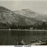
Caption: "Donner Lake," c. 1915-1920. View of Donner Lake, with peaks in background and buildings (possibly resort buildings) on the far shore.
Date: 1915
-
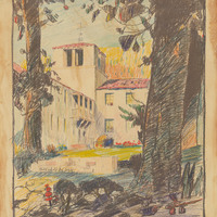
Design and color drawing of California School for the Blind at Berkeley by Alfred Eichler. Built. Project for Department of Education.
Date: 1930
-
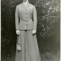
No caption, c. 1915. Grace McCarthy posing in garden with beaded purse. See also 96-07-08-alb05-092, 093, 096, and 097.
Date: 1915
-
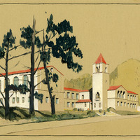
Crayon rendering of girls' and boys' dormitory buildings, California School for the Deaf at Berkeley, by Alfred Eichler. Built. Project for Department of Education.
Date: 1932
-
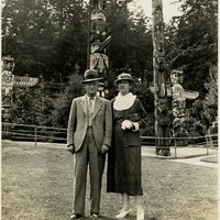
Caption: "Totem Poles Stanley Park - Vancouver, B.C." c. 1935, shows William and Grace McCarthy posing before several large totem poles in Stanley Park, Vancouver.
Date: 1935
-
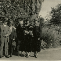
No caption, c. 1915-1920. William (far left) and Grace (second from the right) with three unidentified women, standing in front of garden at an unknown location.
Date: 1920