Search All Items
- Filters:
- Language
- English 6457
- Spanish 23
- ENGLISH 2
- English 2
- census_013 1
- contra_costa_schedule_1_volume_1 1
- Type
- Image 3882
- Still Image 2094
- Text 445
- Text 54
- Textual 2
- Image of the California Census from the records of the office of the California Secretary of State 1
Search Results 6091 to 6100 of 6559
-
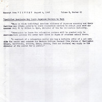
Excerpt from article entitled "Qualified Residents May leave Japanese Centers to Work" regarding leave from relocation centers; referenced in Unmarked Correspondence (F3729_65_007a)
Date: August 4, 1942
-
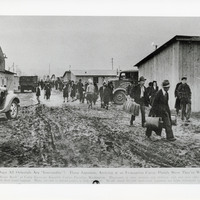
Photograph of Japanese moving into Camp Harmony Assembly Center in Puyallup, Washington
Date: c. 1942
-
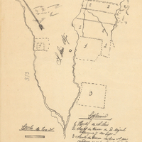
Hand-drawn sketch map of Land at San Luis Obispo boundaries. Volume 2, page 65.
Date: 1843
-
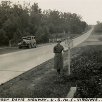
Caption: "Jefferson Davis Highway. U.S. No. 1. Virginia. July 20, 34." Grace McCarthy is standing next to a U.S. Route 1 sign along a highway in Virginia. The Jefferson Davis Highway project was begun by the United Daughters of the Confederacy (UDC). As auto tourism increased across the U.S., so to did the need for roads on which to drive. Private interests such as the UDC began to develop routes across the country, but with no central administrating organization the routes were haphazard and confusing. The UDC planned a route that was to stretch from Virginia across the southern U.S. to San Diego, but the entire route never materialized. The federal government stepped in to impose a numbering system on various routes across the nation. That portion of the planned Jefferson Davis Highway through Virginia was numbered as U.S. Route 1.
Date: 7/20/1934
-
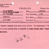
Teletype correspondence regarding the use of resettlement assistance funds to buy bedding
Date: December 12, 1945
-
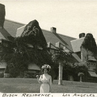
Caption: "Annheuser Busch Residence. Los Angeles," c. 1906. Unidentified woman standing in front of Tudor-style mansion, with several gables and chimneys covered in ivy. Built in 1898 in Pasadena and designed by Frederick Roehrig, the Ivy Wall (the mansion's nickname) was purchased by Adolphus Busch in 1905. Busch gradually bought up much of the surrounding property, and subsequently created the first Busch Gardens. After his death in 1913, his wife Lily continued to develop the gardens. Lily died in 1928. Over the next two decades, the gardens were gradually sold off to real estate developers. The Ivy Wall itself was torn down in 1952.
Date: 1906
-
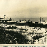
Caption: "Battery covered with snow, Fort Worden, Wash.," c. 1908-1912. Shows the three batteries at Fort Worden covered in a blanket of snow, with the ocean or Puget Sound in the distance. Construction began on the fort in 1898, and by 1902 it was serving as an active U.S. Army base. Fort Worden was part of the "triangle of fire," three coastal defense fortifications (Fort Casey, Fort Worden, and Fort Flagler) guarding the entrance to Puget Sound. The U.S. sold the property to the state of Washington in 1957. In 1973, the fort and surrounding area opened as Fort Worden State Park.
Date: 1908