Search All Items
- Filters:
- Language
- English 6457
- Spanish 23
- ENGLISH 2
- English 2
- census_013 1
- contra_costa_schedule_1_volume_1 1
- Type
- Image 3882
- Still Image 2094
- Text 445
- Text 54
- Textual 2
- Image of the California Census from the records of the office of the California Secretary of State 1
Search Results 6161 to 6170 of 6559
-
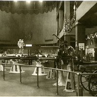
No Caption: See also 96-07-08-alb08-160 with caption: "Government exhibits with navy guns, Government Building." Portland Fair, Oregon, 1905. Shows a variety of naval weaponry. The exhibit was located in the Government Building of the Lewis and Clark Centennial Exposition, held in Portland, Oregon from June 1st to October 15th, 1905. The exposition celebrated the one-hundred year anniversary of the exploratory expedition of the Louisiana Purchase and what became the northwestern part of the United States, led by Meriwether Lewis and William Clark. Some 1.6 million people visited the fair, viewing exhibits from twenty-one countries.
Date: 1905
-
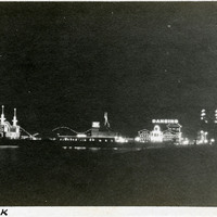
Caption: "Ocean Park," c. 1910. Night view of amusement zone at what became Venice, California. In 1905, Abbot Kinney built a series of canals as part of a development project along Santa Monica Beach, hoping to recreate the look and feel of Italy's iconic "Floating City" in southern California. Called Ocean Park at first, in 1911, the name officially changed to Venice. By 1929, however, many of the canals had been filled in to create roadways, and those that remained fell into disrepair. A revitalization movement in the early 1990s has restored some of the canals, and made the area a desirable residential neighborhood.
Date: 1910
-
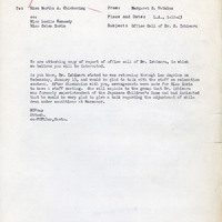
Office Memorandum from Margaret S. Watkins to Martha A. Chickering regarding children at Manzanar
Date: January 12, 1943
-
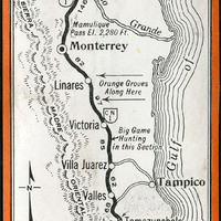
No Caption: A map of the highway from Laredo to Mexico City.
Date: 1938
-
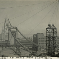
Caption: "San Francisco Bay Bridge Under Construction. Nov. 1, 1935." View of the towers and suspension cables of the western half of the San Francisco-Oakland Bay Bridge, spanning the distance between Yerba Buena Island in San Francisco Bay to the City of San Francisco. The bridge deck has not yet been completed. The Bay Bridge's design combined three different types of bridge-building technology over the five miles it covers between San Francisco and Oakland: a suspension span, a cantilevered span, and a tunnel. At the time of its completion in 1936, the bridge was the longest steel structure on the globe. It also featured the deepest bridge pier ever built, and the world's largest bore tunnel.
Date: 11/1/1935
-
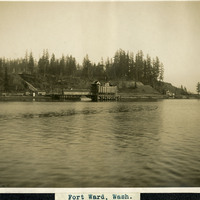
Caption: "Fort Ward, Wash.," c. 1908-1912. View from Puget Sound of a wharf and other buildings of Fort Ward. Originally known as Bean Point, Fort Ward was established by the U.S. Army Coastal Artillery Corps in 1890. Re-named Fort Ward in 1903, the facility included four coastal batteries designed to assist in protecting Puget Sound and the nearby Naval Shipyard from enemy attack. Fort Ward was placed on inactive status in the 1920s, but was revived by the U.S. Navy during World War II. The Navy discovered the fort's location was ideal for listening to radio communications from Japan, and it subsequently became a top secret listening post with a link directly to Washington, D.C. The Navy continued the fort's use as a listening post until 1956, when it was again taken over by the U.S. Army. The Army subsequently stopped all activity in 1958, ultimately selling portions of the fort to the Washington State Park System in 1960. It is now a state park.
Date: 1908
-
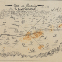
Hand-drawn sketch map of Ensen, or San Bernardo, or San Bernadino boundaries. Volume 1, page 642.
Date: 1841