Search All Items
Search Results 621 to 630 of 5365
-
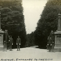
Caption: "Presidio Avenue. Entrance to Presidio," c. 1906. Gateway into the Presidio of San Francisco, bracketed by brick podiums topped by ornamental pinnacles. Three soldiers stand guard at the gate. Established in 1776 by Spanish explorers, the Presidio is a fortified location overlooking the Golden Gate, the entrance into San Francisco Bay. It was closed as a military structure in 1995, and is now a park within the Golden Gate National Recreation Area.
Date: 1906
-
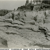
Caption: "An Abandoned Hydraulic Mine near Camptonville Calif.," c. 1920. Hillside ravaged by hydraulic mining, in which a pressurized jet of water washes sediment and gravel into a series of sluices, allowing the heavier gold and gold-carrying sediment to sink to the bottom for removal. California banned this environmentally destructive practice in 1884.
Date: 1920
-
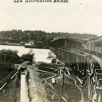
Caption: "New Westminster Bridge.," c. 1908-1912. View of the New Westminster Bridge (also known as the New Westminster Rail Bridge or the Fraser River Swing Bridge), which opened to traffic in 1904. The lower deck carried trains, while the upper deck (which was removed in 1937) was accessible to both foot and vehicle traffic.
Date: 1908
-
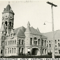
Caption: "Washington State Capitol -- Olympia.," c. 1920. Also known as The Castle, this building served as Washington's state capitol building from 1905 to 1928, when the Legislature moved into the current building. The central tower of The Castle was lost in a 1928 fire, while numerous other towers fell to the 1949 Olympia earthquake. Some of those towers have been restored.
Date: 1920
-
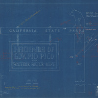
Caption: "Sign for California State Parks." Blueline of drawing by Alfred Eichler of sign for hacienda of Governor Pio Pico, California State Parks, after design by Colonel Wing, Chief Division of Parks. Includes handwritten note attached to drawing and additional annotations. Project for Department of Natural Resources - Beaches and Parks.
Date: 1929
-
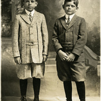
No caption, c. 1905. Two unidentified young boys posing in front of what appears to be a photography studio backdrop.
Date: 1905
-
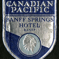
No Caption: A Canadian Pacific Banff Springs Hotel sticker, from the McCarthy's' trip to western Canada, 1935.
Date: 1935
-
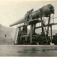
No Caption: undated. Photograph shows what appears to be a 12" disappearing coastal artillery gun, mounted on a rotating carriage.
Date: Undated
-
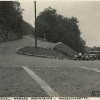
Caption: "Mohawk Trail, Hoosac Mountains, Massachusetts. Greenfield Mass to Albany New York, Sept 7, 1934." Hairpin turn on the Mohawk Trail, a scenic highway in Massachusetts. The Trail, originally a trade route for Native American tribes, was adopted as the route for the first scenic road constructed in the state. A gravel road was built along the route between 1912 and 1914, and later expanded as automobile traffic increased nation-wide. It is now part of Massachusetts Route 2.
Date: 9/7/1934
-
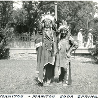
Caption: "Chief Manitou - Manitou Soda Springs," c. 1923. William McCarthy, wearing a Native American headdress and attire, stands next to Pedro Cajete. Mr. Cajete, better known to many as Chief Manitou, was a Native American of the Tewa tribe near Santa Fe, New Mexico, who was hired to promote tourism in the Manitou Springs/Colorado Springs area of Colorado. He often sold trinkets and posed for photographs with tourists near the mouth of Manitou Cave, resulting in his moniker Chief Manitou.
Date: 1923