Search All Items
- Filters:
- Type
- Image 1312
- Still Image 275
- Text 176
- Text 19
- Language
- English 1628
- Spanish 154
- ENGLISH 2
- English 1
- census_013 1
Search Results 51 to 60 of 1804
-
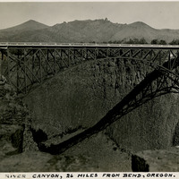
Caption: "Crooked River Canyon, 26 Miles from Bend, Oregon," c. 1935.
Date: 1935
-
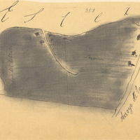
Hand-drawn sketch map of Potrero de los Cerritos boundaries. Volume 2, page 51.
Date: 1840
-
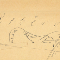
Hand-drawn sketch map of Potrero de los Cerritos boundaries. Volume 2, page 52.
Date: 1840
-
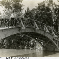
Caption: "Echo Park [sic] Los Angeles," c. 1910. William McCarthy standing on a bridge in Los Angeles' Echo Lake Park. The park opened in 1895. The lake was originally created in 1868 to support the operations of a mill. The mill, however, closed seven years later. The site was later selected for conversion to a city park.
Date: 1910
-
Office Memorandum from Beryl E. Cox to Bertha Underhill regarding resettlement program in Los Angeles County
Date: July 18, 1945
-
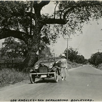
Caption: "Los Angeles -- San Bernardino Boulevard.," c. 1915-1916. Grace McCarthy standing near automobile parked on country road under large oak tree.
Date: 1915
-
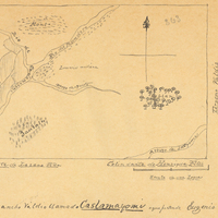
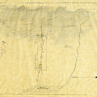
Hand-drawn sketch map of Caslamayomi or Laguna de los Gentiles boundaries. Volume 2, page 57.
Date: 1844
-
Hand-drawn sketch map of Cañada de los Osos y Pecho y Islae boundaries. Volume 2, page 11.
Date: 1842
-
Hand-drawn sketch map of Rio de los Berrendo boundaries. Volume 2, page 98.
Date: 1844
-
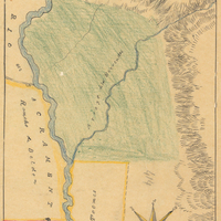
Hand-drawn sketch map of Rio de los Putos boundaries. Volume 1, page 732.
Date: 1842