Search All Items
- Filters:
- Type
- Image 3888
- Still Image 2857
- Text 431
- Text 50
- Image of the California Census from the records of the office of the California Secretary of State 1
- Language
- English 7190
- Spanish 43
- ENGLISH 3
- English 2
- census_013 1
- contra_costa_schedule_1_volume_1 1
Search Results 7151 to 7160 of 7317
-
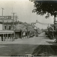
Caption: "Marysville -- Calif.," c. 1920. Main Street of Marysville, California.
Date: 1920
-
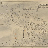
Hand-drawn sketch map of Canadita or Laguna Seca boundaries. Volume 1, page 168.
Date: 1833
-
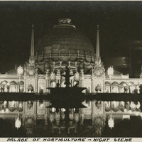
Caption: "Palace of Horticulture - Night Scene," at the Panama-Pacific International Exposition. See also 96-07-08-alb01-116, with caption: "Palace of Horticulture - Night View."
Date: 1915
-
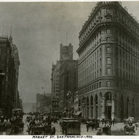
Caption: "Market St. San Francisco -- 1906." Street scene of Market Street in San Francisco before the earthquake and fire of April 1906.
Date: 1906
-
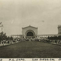
Caption: "Music Stand PC. Expo. San Diego, Cal. July 18, 1915," at the Panama-California Exposition in Balboa Park, San Diego.
Date: 1915
-
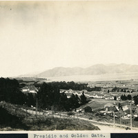
Caption: "Presidio and Golden Gate.," c. 1906. A birds eye view of the Presidio at San Francisco, California, c. 1906. See also 96-07-08-alb02-024.
Date: 1906
-
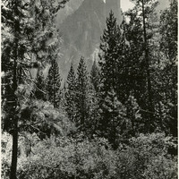
Caption: "Cathedral Spires," c. 1917. Rock formation known as Cathedral Spires in Yosemite National Park, as seen from the valley floor through trees.
Date: 1917
-
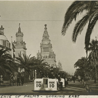
Caption: "Avenue of Palms - Looking East," with Fageol car, at the Panama-Pacific International Exposition. See also 96-07-08-alb03-041.
Date: 1915