Search All Items
- Filters:
- Type
- Image 3888
- Still Image 2857
- Text 431
- Text 50
- Image of the California Census from the records of the office of the California Secretary of State 1
- Language
- English 7190
- Spanish 43
- ENGLISH 3
- English 2
- census_013 1
- contra_costa_schedule_1_volume_1 1
Search Results 7221 to 7230 of 7317
-
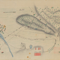
Hand-drawn sketch map of Chichiguas, or San Justo el Viejo and San Bernarbe boundaries. Volume 1, page 306.
Date: 1836
-
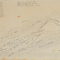
Hand-drawn sketch map of Mission San Juan Bautista boundaries. Volume 1, page 392.
Date: 1836
-
Caption: "Broadway, San Diego, Calif, May 19, 1934." Bird's eye view of Broadway, a main street in San Diego.
Date: 5/19/1934
-
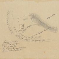
Hand-drawn sketch map of Land- Monterey county, or Lomas del Carmelo or Meadows Tract boundaries. Volume 1, page 520.
Date: 1839
-
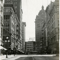
Caption: "Third and Kearney S.F.," c. 1912-1915. Street scene at the intersection of Third Street and Kearney Street in San Francisco.
Date: 1915
-
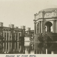
Caption: "Palace of Fine Arts," with reflecting pool at the Panama-Pacific International Exposition. See also 96-07-08-alb01-025.
Date: 1915
-
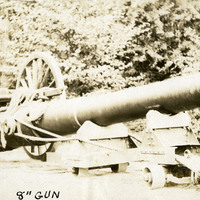
Caption: "8" Gun," c. 1909. Shows the barrel and carriage of an 8" heavy artillery gun, likely used in coastal defense.
Date: 1909
-
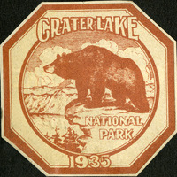
No Caption: A Crater Lake National Park decal, 1935, octagon-shaped, brown and white, with an image of a bear on a cliff that with the lake below.
Date: 1935
-
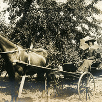
No Caption: Grace McCarthy sitting in a horse-drawn buggy next to an apple tree, likely on the McCarthy property in Watsonville, c. 1906.
Date: 1906