Search All Items
- Filters:
- Language
- English 7210
- Spanish 43
- ENGLISH 3
- English 2
- census_013 1
- contra_costa_schedule_1_volume_1 1
- Type
- Image 3888
- Still Image 2860
- Text 445
- Text 54
- Textual 2
- Image of the California Census from the records of the office of the California Secretary of State 1
Search Results 7231 to 7240 of 7358
-
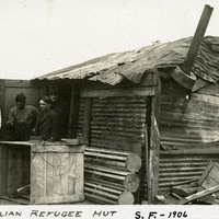
Caption: "Italian Refugee Hut S.F. -- 1906." Makeshift hut with four unidentified men standing in doorway. After the earthquake and fire that destroyed much of San Francisco in April 1906, hundreds of thousands of people were left homeless. Many of these people established temporary refugee camps, using debris from the destruction to cobble together shelters.
Date: 1906
-
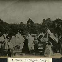
Caption: "A Park Refugee Camp," c. 1906. After the earthquake and fire that destroyed much of San Francisco in April 1906, hundreds of thousands of people were left homeless. Many of these people established temporary refugee camps, using tents or debris from the destruction to cobble together shelters.
Date: 1906
-
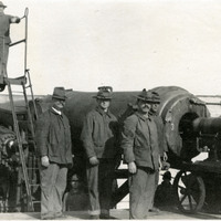
No Caption: c. 1908-1912. Group of men posing around a 12-inch disappearing gun. Retracting or disappearing guns were a form of artillery developed in the nineteenth century in which heavy artillery guns were placed on rotating carriages that allowed retraction of the weapon after firing, to enable reloading while under enemy fire. Such guns were often used in coastal fortifications.
Date: 1908
-
Caption: "Tomb of President Gomez, Havana. July 4th 1934." José Miguel Gómez y Gómez was instrumental in the Cuban War of Independence (1895-1898), and also served as Cuba's President from 1909-1913. Although he died in New York, his remains were interred in the Colon Cemetery in Havana.
Date: 7/4/1934
-
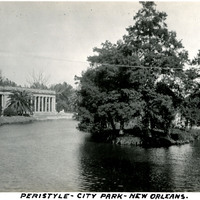
Caption: "Peristyle - City Park- New Orleans," c. 1925. The Neoclassical open air pavilion seen at the left side of this photograph was built in New Orleans' City Park in 1907 to host parties, dances and weddings. It was designed by architect Paul Andry.
Date: 1925
-
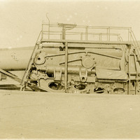
No Caption: c. 1908-1912. Side view of a disappearing coastal artillery gun. Retracting or disappearing guns were a form of artillery developed in the nineteenth century in which heavy artillery guns were placed on rotating carriages that allowed retraction of the weapon after firing, to enable reloading while under enemy fire.
Date: 1908
-
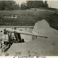
Caption: "6" Disappearing Battery," c. 1905-1909. A 6" disappearing gun in a barbette (gun emplacement). Retracting or disappearing guns were a form of artillery developed in the nineteenth century in which heavy artillery guns were placed on rotating carriages that allowed retraction of the weapon after firing, to enable reloading while under enemy fire.
Date: 1905
-
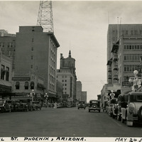
Caption: "Central St. Phoenix, Arizona. May 24, 1934." View from street-level of Phoenix's Central Street.
Date: 5/24/1934
-
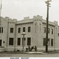
Caption: "Ashland Armory," c. 1915-1920. View of the National Guard Armory built in Ashland, Oregon. Designed by Oregon's first State Architect William C. Knighton, the armory has also been used as a community hall since its construction in 1912-1913.
Date: 1915