Search All Items
Search Results 941 to 950 of 6229
-
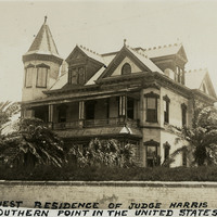
Caption: "Key West Residence of Judge Harris, Most Southern Point in the United States July 2, 1934." View of the Queen Anne-style Victorian mansion constructed in Key West by Judge Vinning Harris in 1897. The home was originally touted as occupying the southernmost point in the U.S., resulting in the colloquial name "Southernmost House." During the Prohibition years (1920-1933) the house operated as a speakeasy, with a restaurant and casino. In 1939, it was converted to use as a nightclub. Today, it has been renovated for use as a bed-and-breakfast.
Date: 7/2/1934
-
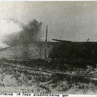
Caption: "Firing 14 Inch Disappearing Gun." This is a copy of a photograph taken by C.D. Heath at the Sandy Hook Proving Ground. It shows a heavy artillery gun firing from an embankment upon which several people stand. Located at Sandy Hook, New Jersey, the Sandy Hook Proving Ground was used by the U.S. Army to test ordinance and materiel from 1874-1919. See also 96-07-08-alb05-102.
Date: 1910
-
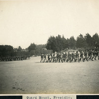
Caption: "Guard Mount. Presidio," c. 1906, shows two groups of men in formation on the Presidio grounds. One group of men is playing musical instruments, while the other group is carrying firearms. Established in 1776 by Spanish explorers, the Presidio is a fortified location overlooking the Golden Gate, the entrance into San Francisco Bay. It was closed as a military structure in 1995, and is now a park within the Golden Gate National Recreation Area.
Date: 1906
-
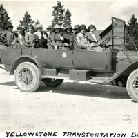
Caption: "Yellowstone Transportation Bus," c. 1923. William and Grace McCarthy (second row from the back, middle and right-hand seats) and a group of unidentified people stop for a photograph while sitting in an eleven-passenger, open-roofed touring bus in Yellowstone National Park. The touring bus, likely made by White Motor Company, was one of a fleet of such vehicles maintained by the Yellowstone Park Transportation Company.
Date: 1923
-
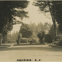
Caption: "Presidio S.F." See also 96-07-08-alb02-021. Entrance to the main post of the Presidio, San Francisco, c. 1910. Established in 1776 by Spanish explorers, the Presidio is a fortified location overlooking the Golden Gate, the entrance into San Francisco Bay. It was closed as a military structure in 1995, and is now a park within the Golden Gate National Recreation Area.
Date: 1910
-
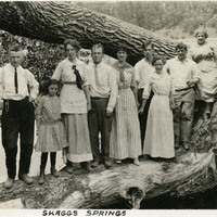
Caption: "Skaggs Springs," c. 1914. William and Grace McCarthy (fourth and fifth from the left) standing on a log with a group of unidentified friends and family in the Skaggs Springs area of Sonoma County. Skaggs Springs was a resort area along the Russian River, known for its hot springs. The area now lies beneath the waters of Lake Sonoma, flooded after construction of the Warm Springs Dam, completed in 1982.
Date: 1914
-
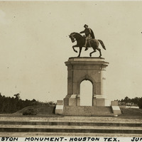
Caption: "Sam Houston Monument -- Houston Tex. June 8, 34." View of the San Houston Monument, a twenty-foot-tall bronze sculpture designed by Enrico Cerracchio and dedicated in 1925. The sculpture commemorates Sam Houston, a prominent soldier and politician who served as the first and third President of the Republic of Texas before its annexation to the U.S. Houston also served as Governor of Texas and as a U.S. Senator for both Texas and Tennessee.
Date: 6/8/1934
-
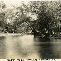
Caption: "Blue Rock Springs - Solano Co." c. 1915. In the 1860s, White Sulphur Springs (in the vicinity of Vallejo) was developed for use as a mineral springs resort, featuring a hotel, several cottages, and an "amusement" building with a dance floor, bar, and billiard room. Manuel Madrid obtained the property around the turn of the twentieth century, and changed the name to Blue Rock Springs. The area is now managed by the Greater Vallejo Recreation District as Blue Rock Springs Park.
Date: 1915
-
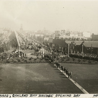
Caption: "San Francisco, Oakland Bay Bridge. Opening Day, Nov. 12, 1936." View of a portion of the ceremonies officially opening the San Francisco-Oakland Bay Bridge to traffic upon its completion in November 1936. The Bay Bridge's design combined three different types of bridge-building technology over the five miles it covers between San Francisco and Oakland: a suspension span, a cantilevered span, and a tunnel. At the time of its completion the bridge was the longest steel structure on the globe. It also featured the deepest bridge pier ever built, and the world's largest bore tunnel.
Date: 11/12/1936
-
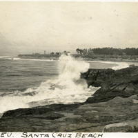
Caption: "Veu-Deleu [sic] Santa Cruz," c. 1910. Ocean shore scene with waves and high spray, with various structures on a promontory in the distance. The Vue de L'eau (View of the Water) was a station on the Santa Cruz, Garfield Park and Capitola Electric Railway electric streetcar line. The station, built in 1891, was located at the very end of the line, on a promontory overlooking the Pacific Ocean. It featured an observatory on the top story. The same company also built a casino, ballroom, and restaurant nearby. The station burned down in 1925. See also 96-07-08-alb08-193.
Date: 1910