Note: To download image right-click on link and "Save-As".
Military Areas
Parent Collection:
California State Government & the Incarceration of Japanese Americans During World War II
Date:
Issued March 2, 1942
Subject:
Military Areas
Description:
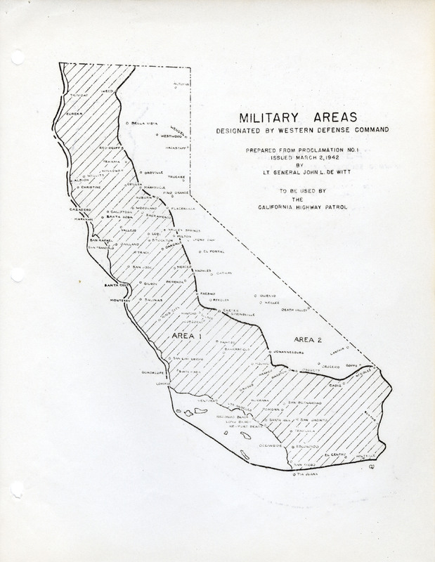
Map of California indicating boundaries for military areas prepared from Proclamation No. 1, issued by Lt. General John L. DeWitt to the California Highway Patrol
Identifier:
F888_426_002
Contributor:
No data available for this field
Publisher:
California State Archives, a division of the California Secretary of State's Office
Right:
There are no known copyright restrictions associated with these digital images. We encourage the use of these images for personal, study, and educational purposes. Please credit “Courtesy of California State Archives.” The California State Archives and the Friends of California Archives cannot be responsible for any use of these images, or any liability resulting from their use. The Archives is interested in learning about any possible copyright restrictions and will gladly remove any image that is in violation.
Source:
F888:426; "Directors Files, 1930-1987"
Format:
400dpi JPEG, 24-bit color
Language:
English
Type:
Still Image