Search All Items
- Filters:
- Type
- Image 1312
- Still Image 275
- Text 176
- Text 19
- Language
- English 1628
- Spanish 154
- ENGLISH 2
- English 1
- census_013 1
Search Results 1 to 10 of 1804
-
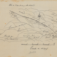
Hand-drawn sketch map of Patrocinio, or Todos Santos y San Antonio boundaries. Volume 1, page 670.
Date: 1840
-
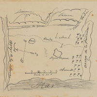
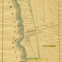
Hand-drawn sketch map of Land-Los Angeles boundaries. Volume 2, page 175.
Date: 1839
-
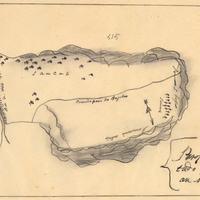
Hand-drawn sketch map of Cienega de los Paicines boundaries. Volume 1, page 780.
Date: 1840
-
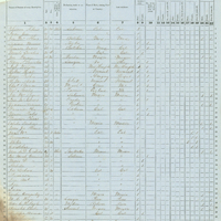
Image of Census of 1852, page 5 from Los Angeles County Schedule I Volume I.
Date: 1852
-
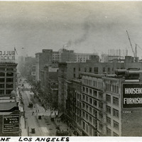
Caption: "Street Scene -- Los Angeles," c. 1910. Rooftop view of an unidentified street in Los Angeles.
Date: 1910
-
Hand-drawn sketch map of Arroyo de los Pilarcitos boundaries. Volume 1, page 588.
Date: 1840
-
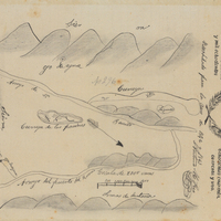
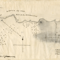
Hand-drawn sketch map of Rio de los Americanos boundaries. Volume 2, page 73.
Date: 1844
-
Hand-drawn sketch map of Rio de los Molinos boundaries. Volume 2, page 87.
Date: 1844
-
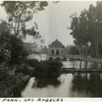
Caption: "East Lake [sic] Park, Los Angeles," c. 1906. Eastlake Park in Los Angeles was originally created by the city in 1881 under the name "East Los Angeles Park." Renamed Eastlake Park in 1901, it gained its current name, Lincoln Park, in 1917. This photograph shows the park's elaborate bandstand and portions of the lake for which the park is named.
Date: 1906