Search All Items
- Filters:
- Type
- Image 1473
- Still Image 304
- Text 72
- Text 19
- Language
- English 1654
- Spanish 215
- ENGLISH 2
- English 1
- census_013 1
Search Results 1 to 10 of 1881
-
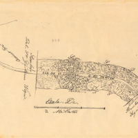
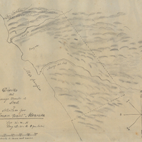
Hand-drawn sketch map of Cañada del Rincon en el Rio San Lorenzo de Santa Cruz boundaries. Volume 2, page 170.
Date: 1843
-
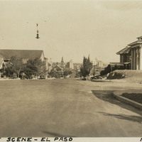
Caption: "Street Scene -- El Paso, May 26, 34." Street scene in El Paso, Texas. Residences line the street in the foreground, while what appears to be a city center can be seen in the center distance.
Date: 5/26/1934
-
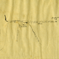
Hand-drawn sketch map of Escarpin, or Las Salinas or El Tucho boundaries. Volume 1, page 26.
Date: 1835
-
Hand-drawn sketch map of Sur or El Sur boundaries. Volume 1, page 68.
Date: 1834
-
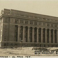
Caption: "Court House -- El Paso Tex. Population of El Paso 100,000, 80% Mexicans. 4000 ft. alt. May 28, 34." View of the El Paso County Courthouse, built in 1917 and designed by Henry Charles Trost. It is not known where William McCarthy got the statistics he quotes in the caption.
Date: 5/28/1934
-
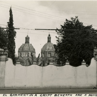
Caption: "Church of El Carmen - in a crypt beneath are a number of mummies, Mexico City."
Date: 1938
-
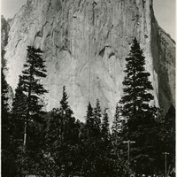
Caption: "El Capitan," c. 1917. El Capitan is a vertical granite rock formation in Yosemite Valley. It's sheer cliff face, rising almost 3,000 feet above the Valley, is a favorite rock climbing location.
Date: 1917