Bookmarks
Showing Bookmarks 1 to 7 of 7
-
-
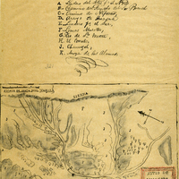
Hand-drawn sketch map of Huasna or Ex-Mission of San Luis Obispo boundaries. Volume 2, page 15.
Date: 1843
-
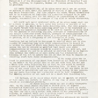
Notice on policies regarding prohibited articles; Sections: Radio Transmitters, Short Wave Radio Receiving Sets, Cameras, Deposit of Prohibited Articles, Penalties
Date: Undated
-
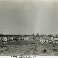
Caption: "Fort Stevens, OR," c. 1915. Panorama of Fort Stevens, built in the 1860s as part of the defensive fortifications guarding the mouth of the Columbia River. Located on the Oregon side of the river, the fort was decommissioned after World War II, its armaments and buildings removed and auctioned off. The site now serves as a state park complete with military museum.
Date: 1915
-
-
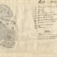
Hand-drawn sketch map of Boca de San Juan boundaries. Volume 2, page 126.
Date: 1845
-