
Bookmarks
Showing Bookmarks 1 to 4 of 4
-
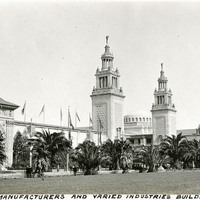
Caption: "Manufacturers and Varied Industries Building," at the Panama-Pacific International Exposition.
Date: 1915
-
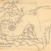
Hand-drawn sketch map of Cañada de Capay boundaries. Volume 2, page 177.
Date: 1845
-

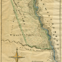
Hand-drawn sketch map of Carrisalitos, or Panoche de San Juan y Carrisalitos, or Rancho de San Juan y Carrisalitos boundaries. Volume 2, page 42.
Date: 1844
-
Hand-drawn sketch map of Barranca Colorada boundaries. Volume 2, page 99.
Date: 1844